Area Overview for RM8 2QT
Photos of RM8 2QT


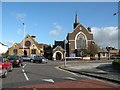
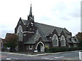


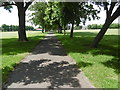
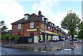
37 photos from this area
Area Information
Key information about the RM8 2QT including its size, population, and administrative classification.
- Area Type
- Postcode
- Area Size
- 3.5 hectares
- Population
- 2404
- Population Density
- 6247 people/km²
House Prices in RM8 2QT
43
Properties
£176,137
Average Sold Price
£52,000
Lowest Price
£375,000
Highest Price
Showing 43 properties
| Address | Type | Beds | Baths | Last Sale Price | Last Sale Date | |
|---|---|---|---|---|---|---|
| 53 Holden Close, Dagenham, RM8 2QT | Terraced | 2 | 1 | £340,000 | Mar 2025 | |
| 56 Holden Close, Dagenham, RM8 2QT | Terraced | 2 | 1 | £335,000 | Feb 2025 | |
| 64 Holden Close, Dagenham, RM8 2QT | Terraced | 1 | 1 | £250,000 | Sep 2023 | |
| 80 Holden Close, Dagenham, RM8 2QT | house | - | - | £375,000 | Sep 2022 | |
| 59 Holden Close, Dagenham, RM8 2QT | house | - | - | £310,000 | Jun 2021 | |
| 73 Holden Close, Dagenham, RM8 2QT | Semi-detached | 2 | 1 | £275,000 | Feb 2019 | |
| 65 Holden Close, Dagenham, RM8 2QT | Terraced | 2 | 1 | £275,000 | Jan 2018 | |
| 78 Holden Close, Dagenham, RM8 2QT | Semi-detached | 2 | 1 | £277,000 | Apr 2017 | |
| 58 Holden Close, Dagenham, RM8 2QT | Terraced | 2 | 1 | £290,000 | Jun 2016 | |
| 48 Holden Close, Dagenham, RM8 2QT | house | - | - | £170,000 | May 2015 |
Page 1 of 5
Energy Efficiency in RM8 2QT
Amenities
Schools
| Rank | School | Type | Entry gender | Ages |
|---|
Explore more schools in this area
Go to Schools tabDemographics
Household Size
Family (3-5 people)
most common
Accommodation Type
Houses
most common
Tenure
49
majority
Ethnic Group
asian_total
most common
Religion
N/A
most common
Household Composition
N/A
most common
Age
47
median
Adults (30-64 years)
most common
Household Deprivation
N/A
with no deprivation
NS-SEC
27
in Lower managerial occupations
Explore more demographic insights in this area
Go to Demographics tabPlanning
Planning Constraints
- Flood RiskPremium
- Ramsar Wetland SitesPremium
- Area of Outstanding Natural BeautyPremium
- Protected Nature ReservePremium
- Protected WoodlandPremium