Area Overview for RM8 2QR
Photos of RM8 2QR

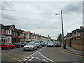
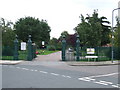
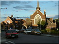

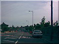
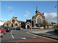
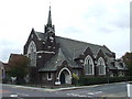


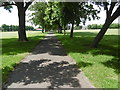
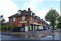
37 photos from this area
Area Information
Key information about the RM8 2QR including its size, population, and administrative classification.
- Area Type
- Postcode
- Area Size
- 3.0 hectares
- Population
- 1657
- Population Density
- 9045 people/km²
House Prices in RM8 2QR
34
Properties
£261,513
Average Sold Price
£63,000
Lowest Price
£1,000,000
Highest Price
Showing 34 properties
| Address | Type | Beds | Baths | Last Sale Price | Last Sale Date | |
|---|---|---|---|---|---|---|
| 32 Stevens Road, Dagenham, RM8 2QR | Terraced | 3 | - | £350,000 | Jun 2025 | |
| 36 Stevens Road, Dagenham, RM8 2QR | Terraced | 3 | 2 | £400,000 | Feb 2025 | |
| 34 Stevens Road, Dagenham, RM8 2QR | house | - | - | £1,000,000 | Jan 2024 | |
| 12 Stevens Road, Dagenham, RM8 2QR | Terraced | 3 | 1 | £360,200 | Nov 2019 | |
| 48 Stevens Road, Dagenham, RM8 2QR | Terraced | 3 | 2 | £320,000 | Feb 2017 | |
| 28 Stevens Road, Dagenham, RM8 2QR | house | 3 | - | £175,000 | Oct 2013 | |
| 40 Stevens Road, Dagenham, RM8 2QR | Terraced | 3 | 1 | £193,000 | Sep 2013 | |
| 58 Stevens Road, Dagenham, RM8 2QR | house | 3 | - | £174,000 | Aug 2012 | |
| 2 Stevens Road, Dagenham, RM8 2QR | house | - | - | £238,500 | Jan 2008 | |
| 20 Stevens Road, Dagenham, RM8 2QR | Terraced | - | - | £180,000 | Apr 2006 |
Page 1 of 4
Energy Efficiency in RM8 2QR
Amenities
Schools
| Rank | School | Type | Entry gender | Ages |
|---|
Explore more schools in this area
Go to Schools tabDemographics
Household Size
Family (3-5 people)
most common
Accommodation Type
Houses
most common
Tenure
46
majority
Ethnic Group
White
most common
Religion
N/A
most common
Household Composition
N/A
most common
Age
47
median
Adults (30-64 years)
most common
Household Deprivation
N/A
with no deprivation
NS-SEC
20
in Lower managerial occupations
Explore more demographic insights in this area
Go to Demographics tabPlanning
Planning Constraints
- Flood RiskPremium
- Ramsar Wetland SitesPremium
- Area of Outstanding Natural BeautyPremium
- Protected Nature ReservePremium
- Protected WoodlandPremium