Area Overview for RM8 2HN
Photos of RM8 2HN
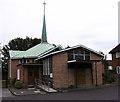
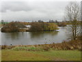
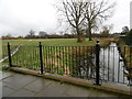
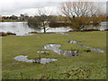
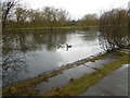

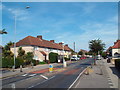
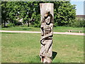
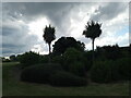
48 photos from this area
Area Information
Key information about the RM8 2HN including its size, population, and administrative classification.
- Area Type
- Postcode
- Area Size
- 8072 m²
- Population
- 2150
- Population Density
- 4131 people/km²
House Prices in RM8 2HN
33
Properties
£218,733
Average Sold Price
£82,000
Lowest Price
£400,000
Highest Price
Showing 33 properties
| Address | Type | Beds | Baths | Last Sale Price | Last Sale Date | |
|---|---|---|---|---|---|---|
| 57 Bromhall Road, Dagenham, RM8 2HN | Terraced | 3 | 1 | £378,000 | Aug 2024 | |
| 63 Bromhall Road, Dagenham, RM8 2HN | Terraced | 3 | 1 | £400,000 | Apr 2023 | |
| 59 Bromhall Road, Dagenham, RM8 2HN | house | 3 | 1 | £300,000 | Apr 2019 | |
| 69 Bromhall Road, Dagenham, RM8 2HN | house | 3 | 1 | £300,000 | Mar 2018 | |
| 60 Bromhall Road, Dagenham, RM8 2HN | Terraced | 3 | 1 | £400,000 | Nov 2016 | |
| 70 Bromhall Road, Dagenham, RM8 2HN | house | - | - | £220,000 | Jan 2015 | |
| 80 Bromhall Road, Dagenham, RM8 2HN | house | 2 | - | £144,000 | Oct 2007 | |
| 96 Bromhall Road, Dagenham, RM8 2HN | house | 3 | 1 | £185,000 | Jun 2007 | |
| 61 Bromhall Road, Dagenham, RM8 2HN | Terraced | 3 | 1 | £171,000 | Dec 2006 | |
| 90 Bromhall Road, Dagenham, RM8 2HN | Terraced | - | - | £155,000 | Jun 2004 |
Page 1 of 4
Energy Efficiency in RM8 2HN
Amenities
Schools
| Rank | School | Type | Entry gender | Ages |
|---|
Explore more schools in this area
Go to Schools tabDemographics
Household Size
Family (3-5 people)
most common
Accommodation Type
Houses
most common
Tenure
33
majority
Ethnic Group
White
most common
Religion
N/A
most common
Household Composition
N/A
most common
Age
47
median
Adults (30-64 years)
most common
Household Deprivation
N/A
with no deprivation
NS-SEC
19
in Lower managerial occupations
Explore more demographic insights in this area
Go to Demographics tabPlanning
Planning Constraints
- Flood RiskPremium
- Ramsar Wetland SitesPremium
- Area of Outstanding Natural BeautyPremium
- Protected Nature ReservePremium
- Protected WoodlandPremium