Area Overview for RM8 2EF
Photos of RM8 2EF
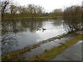

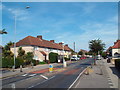
48 photos from this area
Area Information
Key information about the RM8 2EF including its size, population, and administrative classification.
- Area Type
- Postcode
- Area Size
- 8484 m²
- Population
- 1848
- Population Density
- 6493 people/km²
House Prices in RM8 2EF
36
Properties
£202,464
Average Sold Price
£80,000
Lowest Price
£379,000
Highest Price
Showing 36 properties
| Address | Type | Beds | Baths | Last Sale Price | Last Sale Date | |
|---|---|---|---|---|---|---|
| 394 Porters Avenue, Dagenham, RM8 2EF | Terraced | 2 | 1 | £379,000 | Feb 2025 | |
| 344 Porters Avenue, Dagenham, RM8 2EF | Terraced | 3 | 1 | £370,000 | Jun 2023 | |
| 376 Porters Avenue, Dagenham, RM8 2EF | house | - | - | £315,000 | Apr 2021 | |
| 360 Porters Avenue, Dagenham, RM8 2EF | house | 2 | 1 | £290,000 | Dec 2017 | |
| 392 Porters Avenue, Dagenham, RM8 2EF | Terraced | 2 | 1 | £295,000 | Jun 2017 | |
| 362 Porters Avenue, Dagenham, RM8 2EF | Detached | 6 | 2 | £277,000 | May 2016 | |
| 380 Porters Avenue, Dagenham, RM8 2EF | house | 3 | - | £218,000 | Apr 2014 | |
| 390 Porters Avenue, Dagenham, RM8 2EF | house | - | - | £166,500 | Dec 2012 | |
| 370 Porters Avenue, Dagenham, RM8 2EF | house | 3 | - | £215,000 | Sep 2012 | |
| 402 Porters Avenue, Dagenham, RM8 2EF | house | 3 | - | £175,000 | Sep 2011 |
Page 1 of 4
Energy Efficiency in RM8 2EF
Amenities
Schools
| Rank | School | Type | Entry gender | Ages |
|---|
Explore more schools in this area
Go to Schools tabDemographics
Household Size
Family (3-5 people)
most common
Accommodation Type
Houses
most common
Tenure
43
majority
Ethnic Group
White
most common
Religion
N/A
most common
Household Composition
N/A
most common
Age
47
median
Adults (30-64 years)
most common
Household Deprivation
N/A
with no deprivation
NS-SEC
22
in Lower managerial occupations
Explore more demographic insights in this area
Go to Demographics tabPlanning
Planning Constraints
- Flood RiskPremium
- Ramsar Wetland SitesPremium
- Area of Outstanding Natural BeautyPremium
- Protected Nature ReservePremium
- Protected WoodlandPremium