Area Overview for RM8 2DY
Photos of RM8 2DY


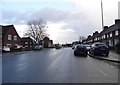


28 photos from this area
Area Information
Key information about the RM8 2DY including its size, population, and administrative classification.
- Area Type
- Postcode
- Area Size
- 4283 m²
- Population
- 1759
- Population Density
- 10713 people/km²
House Prices in RM8 2DY
22
Properties
£245,389
Average Sold Price
£34,000
Lowest Price
£380,000
Highest Price
Showing 22 properties
| Address | Type | Beds | Baths | Last Sale Price | Last Sale Date | |
|---|---|---|---|---|---|---|
| 77 Lillechurch Road, Dagenham, RM8 2DY | house | - | - | £380,000 | Aug 2022 | |
| 76 Lillechurch Road, Dagenham, RM8 2DY | Terraced | 3 | - | £340,000 | Jun 2021 | |
| 83 Lillechurch Road, Dagenham, RM8 2DY | house | - | - | £320,000 | Nov 2020 | |
| 89 Lillechurch Road, Dagenham, RM8 2DY | Terraced | 3 | 1 | £355,000 | Mar 2019 | |
| 81 Lillechurch Road, Dagenham, RM8 2DY | house | 2 | - | £270,000 | Jun 2017 | |
| 75 Lillechurch Road, Dagenham, RM8 2DY | house | - | - | £205,000 | Feb 2014 | |
| 82 Lillechurch Road, Dagenham, RM8 2DY | Terraced | - | - | £172,500 | Sep 2004 | |
| 87 Lillechurch Road, Dagenham, RM8 2DY | Terraced | - | - | £132,000 | Jul 2003 | |
| 78 Lillechurch Road, Dagenham, RM8 2DY | house | - | - | £34,000 | Sep 1996 | |
| 74 Lillechurch Road, Dagenham, RM8 2DY | house | 2 | 2 | - | - |
Page 1 of 3
Energy Efficiency in RM8 2DY
Amenities
Schools
| Rank | School | Type | Entry gender | Ages |
|---|
Explore more schools in this area
Go to Schools tabDemographics
Household Size
Family (3-5 people)
most common
Accommodation Type
Houses
most common
Tenure
40
majority
Ethnic Group
White
most common
Religion
N/A
most common
Household Composition
N/A
most common
Age
47
median
Adults (30-64 years)
most common
Household Deprivation
N/A
with no deprivation
NS-SEC
21
in Lower managerial occupations
Explore more demographic insights in this area
Go to Demographics tabPlanning
Planning Constraints
- Flood RiskPremium
- Ramsar Wetland SitesPremium
- Area of Outstanding Natural BeautyPremium
- Protected Nature ReservePremium
- Protected WoodlandPremium