Area Overview for RM13 8JR
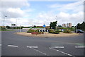
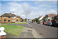
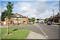
Photos of RM13 8JR


Area Information
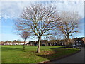
Living in RM13 8JR means residing within a compact residential cluster defined by postcode RM13 8JR. This specific area covers just 4102 square metres, shaping a tight-knit community where daily interactions are frequent and familiar. The population stands at 2469 people, creating a population density of 1001 people per square kilometre. Such density results in closely spaced homes and a distinct sense of place where neighbours often know one another by sight. Residents experience a neighbourhood that prioritises proximity, reducing the distance to essential services while maintaining a residential character distinct from sprawling suburbs. The small footprint of the area ensures that amenities are within practical walking distance for many households, fostering a lifestyle centred on local convenience. Every block in this concentrated zone contributes to the social fabric, making it easy to find shops near RM13 8JR or catch a bus without extensive planning. This environment suits those who value independence and quick access to transport links over the open space found in larger developments. The area represents a practical choice for buyers seeking a defined home zone rather than an undefined rural or massive urban sprawl.
- Area Type
- Postcode
- Area Size
- 4102 m²
- Population
- 2469
- Population Density
- 1001 people/km²
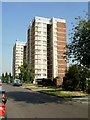
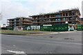
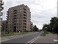
The property market in RM13 8JR is shaped by the fact that houses are the predominant accommodation type. With 60% of residents owning their homes, this area leans heavily towards owner-occupied stock rather than a vibrant private rental market. Buyers looking at homes in RM13 8JR will primarily find traditional houses suited to families rather than high-rise flats or purpose-built rental blocks. This ownership structure implies that houses have been passed down or upgraded over time, potentially offering more character than new builds found in other postcode sectors. The 4102 square metre size of the area limits the total number of properties available, which can drive competition among those seeking to purchase within this specific cluster. Potential buyers should expect to deal with a limited selection of properties due to the small geographical boundaries. The high home ownership rate suggests that sellers in this neighbourhood often plan for long-term retention, which can affect the frequency of transactions compared to hot rental districts. Understanding that this is a buyer's market dominated by houses helps you evaluate whether the local housing stock meets your specific spatial and structural needs.
House Prices in RM13 8JR
Showing 15 properties
| Address | Type | Beds | Baths | Last Sale Price | Last Sale Date | |
|---|---|---|---|---|---|---|
| 14 Evansdale, Rainham, RM13 8JR | Maisonette | 3 | 1 | £330,000 | Apr 2024 | |
| 4 Evansdale, Rainham, RM13 8JR | Maisonette | 2 | 1 | £305,000 | Oct 2023 | |
| 1A Evansdale, Rainham, RM13 8JR | Flat | 1 | 1 | £185,000 | Aug 2017 | |
| 12 Evansdale, Rainham, RM13 8JR | Flat | 2 | 1 | £232,000 | Jun 2017 | |
| 11 Evansdale, Rainham, RM13 8JR | Maisonette | 2 | - | £182,000 | Oct 2014 | |
| 5 Evansdale, Rainham, RM13 8JR | Maisonette | - | - | £135,000 | Jun 2010 | |
| 1 Evansdale, Rainham, RM13 8JR | Flat | - | - | £154,000 | Nov 2007 | |
| 3 Evansdale, Rainham, RM13 8JR | Maisonette | - | - | £128,000 | Feb 2004 | |
| 13 Evansdale, Rainham, RM13 8JR | Flat | - | - | £55,000 | Aug 1999 | |
| 6 Evansdale, Rainham, RM13 8JR | Maisonette | 2 | 1 | - | - |
Energy Efficiency in RM13 8JR
Residents of RM13 8JR enjoy immediate access to a diverse range of amenities within practical reach. Retail options include five nearby locations, with notable stores such as Tesco Rainham and Sainsburys Dagenham offering everyday groceries and household essentials. Transport links are extensive, featuring five rail stations including Rainham Station and Dagenham Dock Station, alongside five metro stops like Dagenham East and Elm Park Station. Two ferry terminals, Woolwich Arsenal Pier and Woolwich Ferry North Pier, provide river crossing options, while London City Airport sits nearby for travel needs. This concentration of facilities means you can reach shops, train stations, and leisure destinations quickly without long commutes. The presence of multiple supermarkets ensures variety in food choices and reasonable travel times for bulk shopping trips. Commuters benefit from direct rail access to central London and regional hubs, making employment options across the capital and Essex easily reachable. The combination of rail, metro, and ferry transport creates a resilient network where if one line is delayed, alternatives remain available. Such connectivity enhances the lifestyle by expanding the effective catchment area for work, entertainment, and socialising without leaving the immediate vicinity.
Amenities
Schools
Families considering schools near RM13 8JR have a clear option in La Salette Catholic Primary School. This institution holds an Ofsted rating of 'good', meeting the standard expectations for state-funded primary education in the area. As a primary school, it caters to younger children, serving as the first educational step for residents with school-aged offspring. The data does not list secondary schools, meaning families with teenagers may need to look further afield for high school education options or rely on the primary selection for earlier years. The presence of a 'good' rated school indicates a baseline of quality in local education, offering reassurance to parents regarding the immediate environment for young learners. With no other primary or secondary schools explicitly named in the available records, La Salette stands as the key educational anchor for households in RM13 8JR. This concentration means parents have a specific institution to engage with for curriculum, extracurricular activities, and future academic reporting. The single-school data point highlights the need for families to plan ahead if they have multiple children requiring different educational stages.
| Rank | School | Type | Entry gender | Ages |
|---|
Explore more schools in this area
Go to Schools tabDemographics
The community in postcode RM13 8JR reflects a settled population with a median age of 47 years. The most common age range falls between adults aged 30 and 64 years, indicating a neighbourhood dominated by working families and older residents who have established roots. Home ownership stands at 60%, suggesting that a clear majority of households own their property outright or with a mortgage, while the remaining 40% likely rent. Houses are the primary accommodation type, meaning flats or bungalows are less common here than traditional single-family homes. The predominant ethnic group is White, aligning with broader trends in specific residential clusters across the region. This demographic profile points towards stability, as long-term residents invest in their properties and stay within the community for generations. The high percentage of owner-occupiers often correlates with lower movement rates, meaning the local school runs and shopping habits remain consistent year after year. Families and individuals in this age bracket typically value quiet streets and reliable services, which supports the desire for a permanent home rather than a temporary rental arrangement.
Household Size
Accommodation Type
Tenure
Ethnic Group
Religion
Household Composition
Age
Household Deprivation
NS-SEC
Explore more demographic insights in this area
Go to Demographics tabPlanning
Planning Constraints
- Flood RiskPremium
- Ramsar Wetland SitesPremium
- Area of Outstanding Natural BeautyPremium
- Protected Nature ReservePremium
- Protected WoodlandPremium