Area Overview for RM13 8SL
Photos of RM13 8SL
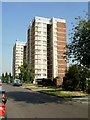
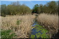

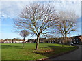

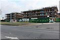
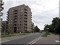

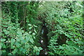
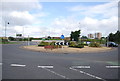
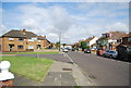
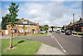
34 photos from this area
Area Information
Key information about the RM13 8SL including its size, population, and administrative classification.
- Area Type
- Postcode
- Area Size
- 2.0 hectares
- Population
- 2469
- Population Density
- 1001 people/km²
House Prices in RM13 8SL
49
Properties
£215,420
Average Sold Price
£32,000
Lowest Price
£392,000
Highest Price
Showing 49 properties
| Address | Type | Beds | Baths | Last Sale Price | Last Sale Date | |
|---|---|---|---|---|---|---|
| 15, Blewitts Cottages, New Road, Rainham, RM13 8SL | Cottage | 3 | 2 | £392,000 | Oct 2025 | |
| 5, Blewitts Cottages, New Road, Rainham, RM13 8SL | Terraced | 2 | 1 | £345,000 | Sep 2025 | |
| 25, Blewitts Cottages, New Road, Rainham, RM13 8SL | Terraced | 3 | - | £330,000 | Jun 2025 | |
| 30, Blewitts Cottages, New Road, Rainham, RM13 8SL | Terraced | 2 | 1 | £290,000 | Apr 2025 | |
| 28, Blewitts Cottages, New Road, Rainham, RM13 8SL | Terraced | 2 | 1 | £376,000 | Aug 2024 | |
| 14, Blewitts Cottages, New Road, Rainham, RM13 8SL | Terraced | 2 | 1 | £335,000 | May 2024 | |
| 19, Blewitts Cottages, New Road, Rainham, RM13 8SL | Terraced | 4 | 1 | £305,000 | Mar 2024 | |
| 29, Blewitts Cottages, New Road, Rainham, RM13 8SL | Terraced | 3 | - | £346,000 | Feb 2024 | |
| 48, Blewitts Cottages, New Road, Rainham, RM13 8SL | house | 2 | - | £365,000 | Jan 2023 | |
| 3, Blewitts Cottages, New Road, Rainham, RM13 8SL | Terraced | 2 | 1 | £330,000 | Jun 2022 |
Page 1 of 5
Energy Efficiency in RM13 8SL
Amenities
Schools
| Rank | School | Type | Entry gender | Ages |
|---|
Explore more schools in this area
Go to Schools tabDemographics
Household Size
Family (3-5 people)
most common
Accommodation Type
Houses
most common
Tenure
60
majority
Ethnic Group
White
most common
Religion
N/A
most common
Household Composition
N/A
most common
Age
47
median
Adults (30-64 years)
most common
Household Deprivation
N/A
with no deprivation
NS-SEC
25
in Lower managerial occupations
Explore more demographic insights in this area
Go to Demographics tabPlanning
Planning Constraints
- Flood RiskPremium
- Ramsar Wetland SitesPremium
- Area of Outstanding Natural BeautyPremium
- Protected Nature ReservePremium
- Protected WoodlandPremium