Area Overview for RM13 7PD
Photos of RM13 7PD


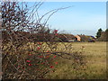


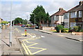
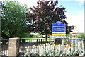

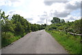
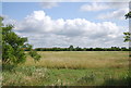

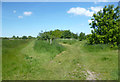
23 photos from this area
Area Information
Key information about the RM13 7PD including its size, population, and administrative classification.
- Area Type
- Postcode
- Area Size
- 7365 m²
- Population
- 1798
- Population Density
- 8611 people/km²
House Prices in RM13 7PD
21
Properties
£261,884
Average Sold Price
£58,000
Lowest Price
£430,000
Highest Price
Showing 21 properties
| Address | Type | Beds | Baths | Last Sale Price | Last Sale Date | |
|---|---|---|---|---|---|---|
| 51 Mungo Park Road, Rainham, RM13 7PD | Terraced | 3 | 1 | £420,000 | Apr 2024 | |
| 84 Mungo Park Road, Rainham, RM13 7PD | house | - | - | £430,000 | Dec 2022 | |
| 43 Mungo Park Road, Rainham, RM13 7PD | Terraced | 3 | - | £365,000 | Mar 2019 | |
| 76 Mungo Park Road, Rainham, RM13 7PD | house | - | - | £348,000 | Jul 2018 | |
| 55 Mungo Park Road, Rainham, RM13 7PD | Terraced | 2 | 3 | £425,000 | Feb 2018 | |
| 62 Mungo Park Road, Rainham, RM13 7PD | house | 4 | - | £275,000 | Jan 2008 | |
| 66 Mungo Park Road, Rainham, RM13 7PD | Terraced | - | - | £205,000 | Mar 2007 | |
| 49 Mungo Park Road, Rainham, RM13 7PD | house | - | - | £182,500 | Aug 2005 | |
| 80 Mungo Park Road, Rainham, RM13 7PD | Terraced | - | - | £195,000 | May 2005 | |
| 53 Mungo Park Road, Rainham, RM13 7PD | Terraced | - | - | £158,000 | Nov 2002 |
Page 1 of 3
Energy Efficiency in RM13 7PD
Amenities
Schools
| Rank | School | Type | Entry gender | Ages |
|---|
Explore more schools in this area
Go to Schools tabDemographics
Household Size
Family (3-5 people)
most common
Accommodation Type
Houses
most common
Tenure
58
majority
Ethnic Group
White
most common
Religion
N/A
most common
Household Composition
N/A
most common
Age
47
median
Adults (30-64 years)
most common
Household Deprivation
N/A
with no deprivation
NS-SEC
26
in Lower managerial occupations
Explore more demographic insights in this area
Go to Demographics tabPlanning
Planning Constraints
- Flood RiskPremium
- Ramsar Wetland SitesPremium
- Area of Outstanding Natural BeautyPremium
- Protected Nature ReservePremium
- Protected WoodlandPremium