Area Overview for RM13 7DT
Photos of RM13 7DT


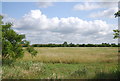

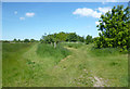
23 photos from this area
Area Information
Key information about the RM13 7DT including its size, population, and administrative classification.
- Area Type
- Postcode
- Area Size
- 6089 m²
- Population
- 1695
- Population Density
- 7715 people/km²
House Prices in RM13 7DT
25
Properties
£310,916
Average Sold Price
£121,995
Lowest Price
£590,000
Highest Price
Showing 25 properties
| Address | Type | Beds | Baths | Last Sale Price | Last Sale Date | |
|---|---|---|---|---|---|---|
| 55 Jersey Road, Rainham, RM13 7DT | Terraced | 4 | 3 | £480,000 | Oct 2025 | |
| 44 Jersey Road, Rainham, RM13 7DT | Terraced | 3 | 1 | £430,000 | Nov 2023 | |
| 53 Jersey Road, Rainham, RM13 7DT | Terraced | 5 | 3 | £590,000 | Dec 2022 | |
| 56 Jersey Road, Rainham, RM13 7DT | Terraced | 3 | - | £350,000 | Apr 2022 | |
| 59 Jersey Road, Rainham, RM13 7DT | Terraced | 3 | 1 | £375,000 | Dec 2020 | |
| 67 Jersey Road, Rainham, RM13 7DT | Terraced | 3 | 1 | £390,000 | Mar 2018 | |
| 57 Jersey Road, Rainham, RM13 7DT | house | - | - | £242,000 | Jun 2014 | |
| 42 Jersey Road, Rainham, RM13 7DT | Terraced | 3 | - | £250,000 | Jul 2013 | |
| 63 Jersey Road, Rainham, RM13 7DT | house | 3 | - | £210,000 | Apr 2013 | |
| 50 Jersey Road, Rainham, RM13 7DT | Terraced | 3 | - | £168,500 | Jun 2003 |
Page 1 of 3
Energy Efficiency in RM13 7DT
Amenities
Schools
| Rank | School | Type | Entry gender | Ages |
|---|
Explore more schools in this area
Go to Schools tabDemographics
Household Size
Family (3-5 people)
most common
Accommodation Type
Houses
most common
Tenure
80
majority
Ethnic Group
White
most common
Religion
N/A
most common
Household Composition
N/A
most common
Age
47
median
Adults (30-64 years)
most common
Household Deprivation
N/A
with no deprivation
NS-SEC
28
in Lower managerial occupations
Explore more demographic insights in this area
Go to Demographics tabPlanning
Planning Constraints
- Flood RiskPremium
- Ramsar Wetland SitesPremium
- Area of Outstanding Natural BeautyPremium
- Protected Nature ReservePremium
- Protected WoodlandPremium