Area Overview for RM13 7DD
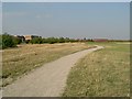
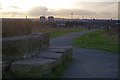
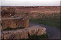
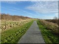
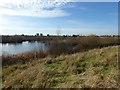
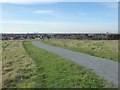
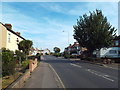
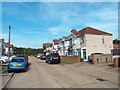
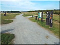
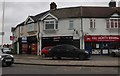
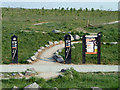
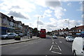
Photos of RM13 7DD
Area Information
Living in RM13 7DD means residing in a very small residential cluster defined by this specific postcode. The area covers just 3,056 square metres and contains a population of 1,732 people. This tight configuration creates an unusually high density of 566,766 people per square kilometre. Despite the compact size, the location offers direct access to major transport networks including Elm Park Station, Rainham Station, and Woolwich Arsenal Pier. Daily life centres around immediate proximity to retail hubs like Tesco Rainham and Chelmsford Star Co-operative Society. The postcode does not encompass any protected natural areas such as AONBs or Ramsar wetland sites. Instead, residents navigate a built environment that prioritises convenience over open space. You will find yourselves in a setting where every facility is within practical reach. The sheer concentration of people in such a small footprint defines the character of this neighbourhood.
- Area Type
- Postcode
- Area Size
- 3056 m²
- Population
- 1732
- Population Density
- 1791 people/km²
The property market within RM13 7DD is dominated by Houses rather than flats or apartments. This architectural preference aligns with the high home ownership rate of 72 per cent. You are mostly looking at owner-occupied stock rather than a rental market. The small land size of 3,056 square metres limits the variety of housing types available. Buyers might find standard detached or semi-detached homes rather than high-density developments. The area does not contain protected planning constraints like woodland or nature reserves. This allows for straightforward ownership without environmental restrictions affecting most properties. The lack of flats means space is premium. Prospective buyers should expect to compete for established Houses. Prices reflect the scarcity of land and the strong preference for owning rather than renting in this cluster.
House Prices in RM13 7DD
Showing 12 properties
| Address | Type | Beds | Baths | Last Sale Price | Last Sale Date | |
|---|---|---|---|---|---|---|
| 11 Avelon Road, Rainham, RM13 7DD | Terraced | 3 | 1 | £300,000 | Jan 2020 | |
| 17 Avelon Road, Rainham, RM13 7DD | Terraced | - | - | £218,000 | Sep 2010 | |
| 13 Avelon Road, Rainham, RM13 7DD | house | - | - | £192,000 | Feb 2007 | |
| 25 Avelon Road, Rainham, RM13 7DD | Terraced | - | - | £230,000 | Nov 2005 | |
| 15 Avelon Road, Rainham, RM13 7DD | Terraced | - | - | £167,500 | Feb 2003 | |
| 9 Avelon Road, Rainham, RM13 7DD | Terraced | - | - | £148,950 | Nov 2002 | |
| 27 Avelon Road, Rainham, RM13 7DD | Terraced | - | - | £63,500 | Jul 1998 | |
| 23 Avelon Road, Rainham, RM13 7DD | Terraced | - | - | - | - | |
| 31 Avelon Road, Rainham, RM13 7DD | house | - | - | - | - | |
| 21 Avelon Road, Rainham, RM13 7DD | house | - | - | - | - |
Energy Efficiency in RM13 7DD
Residents of RM13 7DD enjoy immediate access to a variety of amenities. Five retail locations are nearby, including Tesco Rainham, Chelmsford Star Co-operative Society Co, and Tesco Hornchurch. Five Metro stations serve the area, offering connections to Elm Park Station, Dagenham East, and Hornchurch. Five rail stations provide further flexibility through Rainham Station, Dagenham Dock Station, and Emerson Park Station. One ferry option is available at Woolwich Arsenal Pier. This concentration allows for convenient shopping and commuting. You can reach supermarkets and tube stations without significant travel times. The diversity of transport modes means you can switch between trains, tubes, and ferries easily. Daily errands become simple tasks within the built-up environment. The area lacks traditional parks or nature reserves but compensates with strong commercial infrastructure.
Amenities
Schools
Routes4Life Limited is the nearest educational institution to RM13 7DD. This facility operates as a Special school. There are no comprehensive primary or secondary schools listed immediately adjacent to this specific postcode. The presence of a special education centre indicates tailored learning support for specific needs. Families considering homes in RM13 7DD must rely solely on this provision for nearby education. You will need to look beyond the immediate cluster for mainstream schooling options. The limited school data suggests that residential clusters of this size often depend on wider municipal catchment areas. Routes4Life Limited serves the local community with a focused remit. Parents should verify travel times and catchment boundaries carefully before committing to a purchase in this tight residential zone.
| Rank | School | Type | Entry gender | Ages |
|---|
Explore more schools in this area
Go to Schools tabDemographics
The community in RM13 7DD is defined by a median age of 47 years. Adults between the ages of 30 and 64 represent the most common age range among residents. Home ownership stands at 72 per cent of households. This substantial majority indicates a settled population rather than a transient community. The predominant ethnic group is White. Most dwellings in the area are Houses, catering primarily to families or individuals seeking standalone properties. There are no data points available regarding deprivation levels for this specific postcode. The high home ownership figure suggests long-term investment in the locality. Residents are likely entrenched in this environment due to stable employment or multi-generational housing. The demographic profile points towards a mature community with established ties to the property market.
Household Size
Accommodation Type
Tenure
Ethnic Group
Religion
Household Composition
Age
Household Deprivation
NS-SEC
Explore more demographic insights in this area
Go to Demographics tabPlanning
Planning Constraints
- Flood RiskPremium
- Ramsar Wetland SitesPremium
- Area of Outstanding Natural BeautyPremium
- Protected Nature ReservePremium
- Protected WoodlandPremium