Area Overview for RM12 5ET
Photos of RM12 5ET
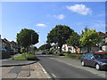
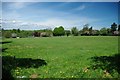
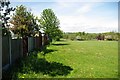
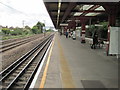
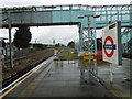
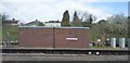
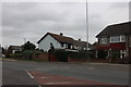
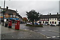
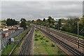
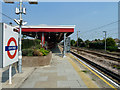
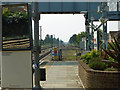
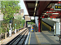
27 photos from this area
Area Information
Key information about the RM12 5ET including its size, population, and administrative classification.
- Area Type
- Postcode
- Area Size
- 6406 m²
- Population
- 1673
- Population Density
- 8262 people/km²
House Prices in RM12 5ET
23
Properties
£191,862
Average Sold Price
£59,995
Lowest Price
£470,000
Highest Price
Showing 23 properties
| Address | Type | Beds | Baths | Last Sale Price | Last Sale Date | |
|---|---|---|---|---|---|---|
| 74 Ambleside Avenue, Hornchurch, RM12 5ET | Semi-detached | 4 | 2 | £470,000 | Dec 2023 | |
| 82 Ambleside Avenue, Hornchurch, RM12 5ET | Maisonette | 2 | 1 | £285,000 | Apr 2021 | |
| 80 Ambleside Avenue, Hornchurch, RM12 5ET | Maisonette | 2 | 1 | £250,000 | Jul 2018 | |
| 68 Ambleside Avenue, Hornchurch, RM12 5ET | Flat | - | - | £155,000 | May 2013 | |
| 86 Ambleside Avenue, Hornchurch, RM12 5ET | Flat | - | - | £164,995 | Jun 2010 | |
| 46 Ambleside Avenue, Hornchurch, RM12 5ET | Terraced | - | - | £275,000 | Mar 2007 | |
| 62 Ambleside Avenue, Hornchurch, RM12 5ET | Flat | - | - | £137,500 | Jun 2004 | |
| 54 Ambleside Avenue, Hornchurch, RM12 5ET | Flat | - | - | £107,000 | Oct 2002 | |
| 88 Ambleside Avenue, Hornchurch, RM12 5ET | Flat | - | - | £104,995 | Jan 2002 | |
| 90 Ambleside Avenue, Hornchurch, RM12 5ET | Maisonette | 2 | 1 | £100,995 | Jan 2002 |
Page 1 of 3
Energy Efficiency in RM12 5ET
Amenities
Schools
| Rank | School | Type | Entry gender | Ages |
|---|
Explore more schools in this area
Go to Schools tabDemographics
Household Size
Family (3-5 people)
most common
Accommodation Type
Flats
most common
Tenure
44
majority
Ethnic Group
White
most common
Religion
N/A
most common
Household Composition
N/A
most common
Age
47
median
Adults (30-64 years)
most common
Household Deprivation
N/A
with no deprivation
NS-SEC
23
in Lower managerial occupations
Explore more demographic insights in this area
Go to Demographics tabPlanning
Planning Constraints
- Flood RiskPremium
- Ramsar Wetland SitesPremium
- Area of Outstanding Natural BeautyPremium
- Protected Nature ReservePremium
- Protected WoodlandPremium