Area Overview for RM11 3YD
Photos of RM11 3YD
Area Information
Living in RM11 3YD means settling in a specific postcode area that covers a small residential cluster of 2,894 square metres. You will find 1,981 residents within this compact boundary, resulting in one of the high population densities recorded for the region. The area functions as a containing zone where daily life revolves around proximity to significant transport nodes and retail hubs just outside the immediate perimeter. This tight configuration suggests a neighbourhood designed for efficiency rather than sprawling suburban expansion. Residents navigate a space where housing sits close together, creating an environment where noise and activity travel easily between properties. The sheer density of 684,468 people per square kilometre is a defining characteristic that impacts your choice of street and window orientation. Expect a locality where the air feels thick with activity, as the land area does not spread out to dilute the presence of its inhabitants. When you consider homes in RM11 3YD, you are choosing a location defined by its administrative precision and its closeness to major infrastructure.
- Area Type
- Postcode
- Area Size
- 2894 m²
- Population
- 1981
- Population Density
- 5454 people/km²
You will find that the property market in RM11 3YD revolves almost entirely around flats. This accommodation type is not merely an option but the predominant form of housing throughout this specific postcode area. The fact that nearly 50% of residents are homeowners indicates that buying into this market is a viable path to entry, even if the physical volume of land is small. With 49% home ownership, the area avoids the extremes of a purely investment-driven rental zone. These figures suggest that the housing stock consists largely of residential units designed for long-term living rather than short-term letting. The 2,894 square metre footprint restricts house size, meaning buyers in RM11 3YD must adapt to vertical living solutions. This constraint creates a market where every square foot carries a premium value. You will not find detached houses or large family estates in this specific cluster. Instead, you encounter a concentration of residential flats that cater to the needs of adults aged 30 to 64. This mixture creates a predictable environment where the primary asset is the property unit itself rather than the surrounding garden or grounds.
House Prices in RM11 3YD
Showing 13 properties
| Address | Type | Beds | Baths | Last Sale Price | Last Sale Date | |
|---|---|---|---|---|---|---|
| 153A High Street, Hornchurch, RM11 3YD | Flat | - | - | £280,000 | Dec 2007 | |
| 155A High Street, Hornchurch, RM11 3YD | Maisonette | - | - | £150,000 | Jun 1996 | |
| 147A High Street, Hornchurch, RM11 3YD | Maisonette | - | - | - | - | |
| 151B High Street, Hornchurch, RM11 3YD | Maisonette | 2 | 1 | - | - | |
| 137A High Street, Hornchurch, RM11 3YD | Office | - | - | - | - | |
| 143A High Street, Hornchurch, RM11 3YD | Maisonette | 2 | 1 | - | - | |
| 145A High Street, Hornchurch, RM11 3YD | Maisonette | - | - | - | - | |
| Flat, 135 High Street, Hornchurch, RM11 3YD | Flat | - | - | - | - | |
| 139B High Street, Hornchurch, RM11 3YD | Office | - | - | - | - | |
| 139A High Street, Hornchurch, RM11 3YD | Office | - | - | - | - |
Energy Efficiency in RM11 3YD
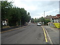
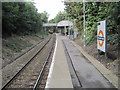
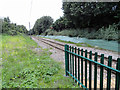
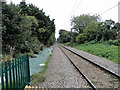
Amenities within practical reach of RM11 3YD are concentrated in nearby stations and retail parks rather than deep within the 2,894 square metre block. You have access to five retail locations including Iceland Hornchurch, Sainsburys Hornchurch, and Lidl Hornchurch within easy commuting range. Transport links are extensive, with five rail stations available including Emerson Park Station, Upminster Station, and Gidea Park Station. Additionally, five metro stations serve the area such as Hornchurch, Upminster Bridge, and Elm Park Station. This setup means you do not need a car to reach essential goods or daily commuting hubs. Shopping trips to Sainsburys or Iceland require a short journey but fit easily into a weekly routine. The density of transport nodes ensures that you can access the wider Hornchurch and Upminster economic zones quickly. Your lifestyle in this postcode benefits from this immediate proximity to commercial and transit hubs.
Amenities
Schools
Schools near RM11 3YD offer strong options with multiple institutions holding good Ofsted ratings. Langtons Infant School & Nursery serves the youngest children with a good rating from Ofsted. Langtons Junior School continues this educational provision during the primary phase, maintaining the same standard of quality. Further education is available through Langtons Junior Academy, which holds an academy status and carries a good Ofsted assessment. This collection of schools provides a continuous pathway for children without the need to travel far for different stages of their education. The presence of an academy school alongside traditional infant and junior schools suggests a modern approach to educational management within the catchment. For families living in RM11 3YD, these institutions provide a reliable local education. The consistent 'good' rating across all three named schools indicates a stable performance record. You can expect your children to access education that meets national standards right on your doorstep.
| Rank | School | Type | Entry gender | Ages |
|---|
Explore more schools in this area
Go to Schools tabDemographics
The community in RM11 3YD is dominated by the adult demographic, with 49% of the population falling into the 30 to 64 years age range. The median age stands at 47, confirming that the most common residents are experienced homeowners working within or approaching retirement. This age profile suggests a stable population where families and established professionals have put down permanent roots. House ownership stands at 49%, placing the area almost precisely on the dividing line between rental markets and owner-occupied sectors. Nearly half of the households possess their homes outright or through mortgage, indicating a level of financial stability among residents. Flats form the predominant accommodation type, a fact that explains the high density and efficient use of the 2,894 square metre area. The area is also 99% White, reflecting the predominant ethnic group recorded for the postcode. While specific deprivation data is absent from the current records, the concentration of adult home ownership suggests a neighbourhood without extreme economic volatility. The demographics point to a mature enclave where life moves at the rhythm of a working adult population.
Household Size
Accommodation Type
Tenure
Ethnic Group
Religion
Household Composition
Age
Household Deprivation
NS-SEC
Explore more demographic insights in this area
Go to Demographics tabPlanning
Planning Constraints
- Flood RiskPremium
- Ramsar Wetland SitesPremium
- Area of Outstanding Natural BeautyPremium
- Protected Nature ReservePremium
- Protected WoodlandPremium