Area Overview for RM11 3SY
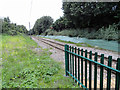
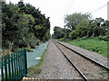
Photos of RM11 3SY
Area Information
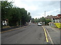
RM11 3SY is a tightly defined residential postcode covering just 1.7 hectares. This small footprint indicates a compact cluster within the broader Ravensbourne and Northbrook area of Hornchurch. With a population of 1,507 people, the area maintains a close-knit character within the London Borough of Havering. Life here revolves around permanent housing rather than transient accommodation, creating stable neighbourhoods where long-term residents dominate. The location sits firmly within Greater London, approximately 20 miles east of Charing Cross, placing it in a well-established commuter corridor. Living in RM11 3SY means accessing a specific slice of suburban life where space is efficient. The high population density of 87,620 people per square kilometre reflects a developed site with limited room for expansion. You will find a settled community defined by its existing built environment. This postcode does not span large parks or extensive commercial stretches on its own; instead, it serves as a residential pocket connecting to larger hubs nearby. The area benefits from being part of a larger infrastructure network while retaining the focus of a home-centric cluster.
- Area Type
- Postcode
- Area Size
- 1.7 hectares
- Population
- 1507
- Population Density
- 4457 people/km²
The housing market for RM11 3SY is defined by a strong owner-occupier presence. With 78% home ownership, the majority of residents are free to trade or refine their housing without the complexities of the rental sector. This statistic indicates a mature market where buyers are purchasing homes to stay rather than renting for short-term gains. Predominant accommodation types are houses, meaning your focus for viewing will likely fall on detached, semi-detached, or terraced properties rather than flats or apartments. This high ownership rate often leads to slower transaction speeds as sellers may have fewer incentives to rush. Prices in this cluster reflect the scarcity of land within the 1.7-hectare boundary and the desirability of house-based living compared to other postcode sectors. Because the area is self-contained within the larger Hornchurch landscape, buyers targeting RM11 3SY must consider proximity to Amhurst Road or adjacent thoroughfares. The market is not speculative but rather grounded in practical relocation needs. Families and downsizers looking for established stone-built housing will find this postcode aligns with their requirements.
House Prices in RM11 3SY
Showing 39 properties
| Address | Type | Beds | Baths | Last Sale Price | Last Sale Date | |
|---|---|---|---|---|---|---|
| 36 Glanville Drive, Hornchurch, RM11 3SY | Semi-detached | 2 | 1 | £565,000 | Mar 2025 | |
| 19 Glanville Drive, Hornchurch, RM11 3SY | Bungalow | - | - | £620,000 | Jun 2024 | |
| 47A Glanville Drive, Hornchurch, RM11 3SY | Bungalow | 2 | 1 | £490,000 | Oct 2023 | |
| 38 Glanville Drive, Hornchurch, RM11 3SY | Semi-detached | 3 | 2 | £653,000 | Jan 2023 | |
| 46 Glanville Drive, Hornchurch, RM11 3SY | Retail | 2 | 1 | £536,000 | Jun 2022 | |
| 17 Glanville Drive, Hornchurch, RM11 3SY | Detached | - | - | £400,000 | Dec 2020 | |
| 21 Glanville Drive, Hornchurch, RM11 3SY | Chalet | 4 | 1 | £499,000 | Mar 2019 | |
| 39 Glanville Drive, Hornchurch, RM11 3SY | Bungalow | - | - | £465,000 | Jul 2017 | |
| 29 Glanville Drive, Hornchurch, RM11 3SY | Semi-detached | 4 | - | £370,000 | Jul 2013 | |
| 37 Glanville Drive, Hornchurch, RM11 3SY | Semi-detached | 3 | - | £347,500 | Jun 2013 |
Energy Efficiency in RM11 3SY
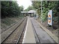
Living in RM11 3SY places you within easy reach of significant retail and transport hubs. Upminster Bridge, Hornchurch, and Elm Park Station offer five distinct metro connections for commuters. Local shopping needs are met by Co-op Upminster, Iceland Hornchurch, and Sainsburys Hornchurch, all within practical reach. You can access these amenities without lengthy journeys, allowing for quick grocery runs and weekend errands. Rail links via Emerson Park Station, Upminster Station, and Gidea Park Station provide robust connections to central London and surrounding regions. This network ensures you can access wider leisure opportunities while maintaining a local pace. The presence of multiple retail chains means you do not lack variety in food or household goods. Residents can walk to nearby supermarkets or catch a train for broader exploration. This blend of local convenience and macro connectivity defines the daily rhythm of life in this postcode.
Amenities
Schools
Families living in RM11 3SY benefit from proximity to key educational institutions. Dury Falls School stands nearby as a primary option for younger children residing in this vicinity. For older students, Havering Sixth Form College provides a critical pathway for academic progression. While specific Ofsted ratings are not included in the current data, the presence of these named institutions confirms the area's integration into the local education network. The mix of schools indicates a route from early education through to sixth form preparation. Parents in this postcode do not need to travel far beyond the immediate neighbourhood for schooling arrangements. Dury Falls School serves the primary needs of local graduates, ensuring continuity for young residents. Havering Sixth Form College supports older students ready to transition to university or apprenticeship programmes. This arrangement reduces commute times for students and simplifies logistics for parents working full-time. Both facilities are situated within practical reach of homes in RM11 3SY.
| Rank | School | Type | Entry gender | Ages |
|---|
Explore more schools in this area
Go to Schools tabDemographics
The community in RM11 3SY reflects a mature demographic profile typical of established London suburbs. The median age stands at 47 years, confirming that the most common age group comprises adults between 30 and 64 years old. This age distribution suggests a population that has likely settled down, balancing careers with family life or retirement planning. Home ownership is the dominant tenure method, with 78% of residents owning their properties outright or with a mortgage. This high level of ownership frequently correlates with longer-term residency and investment stability. Accommodation in this postcode consists almost entirely of houses. You will not find significant clusters of purpose-built flats or social housing within this specific 1.7-hectare area. The predominant ethnic group is White, aligning with general patterns for the Hornchurch local authority. These figures paint a picture of a tranquil residential zone suited to families and individuals seeking stability. The lack of mixed tenure suggests a uniform quality of living standards across the neighbourhood. Residents here are likely invested in the area's future, contributing to a sense of continuity that defines daily life in this specific cluster.
Household Size
Accommodation Type
Tenure
Ethnic Group
Religion
Household Composition
Age
Household Deprivation
NS-SEC
Explore more demographic insights in this area
Go to Demographics tabPlanning
Planning Constraints
- Flood RiskPremium
- Ramsar Wetland SitesPremium
- Area of Outstanding Natural BeautyPremium
- Protected Nature ReservePremium
- Protected WoodlandPremium