Area Overview for RM11 3ST
Photos of RM11 3ST
Area Information
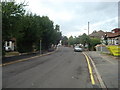
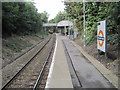
Living in RM11 3ST means settling into a compact residential cluster defined by its proximity to Upminster. This postcode covers a specific area of just 2.9 hectares, making it a tightly knit community rather than a sprawling district. The environment is characterised by a high concentration of residents, with a density that places 51,711 people per square kilometre within this small footprint. You will find that daily life here is efficient and straightforward, supported by the immediate presence of major rail hubs like Emerson Park Station and Gidea Park Station. While the physical space is limited, the strategic location ensures you are never far from practical necessities. The area serves as a quiet backdrop for those seeking a home near the town centres of Upminster Bridge, Hornchurch, and Elm Park. This postcode represents a slice of English living where space is curated rather than expansive, offering residents a distinct sense of place within the wider Havering borough without the noise of a larger city environment.
- Area Type
- Postcode
- Area Size
- 2.9 hectares
- Population
- 1507
- Population Density
- 4457 people/km²
The property market in RM11 3ST is dominated by owner-occupied housing, as confirmed by the 78% home ownership rate. This figure indicates that the vast majority of the housing stock comprises Houses, aligning with the preferences of the current resident population. You are looking at an area where empty rental units are scarce, and the local real estate landscape is built around permanent family homes rather than student flats or temporary lets. When considering homes in RM11 3ST, you can expect a consistent build quality and tenure that appeals to buyers seeking stability. The nature of the accommodation means the market moves slightly slower than high-rental zones, with transactions often reflecting long-term rather than short-term planning. This stability is a key feature for anyone purchasing property in this postcode, ensuring the local housing environment remains focused on established families.
House Prices in RM11 3ST
Showing 42 properties
| Address | Type | Beds | Baths | Last Sale Price | Last Sale Date | |
|---|---|---|---|---|---|---|
| 2A Maywin Drive, Hornchurch, RM11 3ST | Maisonette | 2 | 1 | £302,500 | Sep 2025 | |
| 4A Maywin Drive, Hornchurch, RM11 3ST | Maisonette | 2 | 1 | £295,000 | Mar 2025 | |
| 19A Maywin Drive, Hornchurch, RM11 3ST | Maisonette | 2 | 1 | £300,000 | Apr 2024 | |
| 17A Maywin Drive, Hornchurch, RM11 3ST | Flat | 2 | 1 | £290,000 | Aug 2023 | |
| 13A Maywin Drive, Hornchurch, RM11 3ST | Maisonette | - | - | £280,000 | Feb 2022 | |
| 1A Maywin Drive, Hornchurch, RM11 3ST | Maisonette | 2 | 1 | £300,000 | Jan 2022 | |
| 14A Maywin Drive, Hornchurch, RM11 3ST | Flat | - | - | £278,500 | Aug 2021 | |
| 20A Maywin Drive, Hornchurch, RM11 3ST | Maisonette | 2 | - | £295,000 | Sep 2020 | |
| 26 Maywin Drive, Hornchurch, RM11 3ST | Semi-detached | 3 | 1 | £492,000 | Nov 2019 | |
| 20 Maywin Drive, Hornchurch, RM11 3ST | Maisonette | 2 | - | £295,000 | Jul 2019 |
Energy Efficiency in RM11 3ST
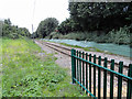
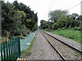
Your lifestyle in RM11 3ST is defined by convenient access to essential amenities within a short travel radius. Retail options are plentiful, with major supermarkets like Co-op Upminster, Iceland Hornchurch, and Sainsburys Hornchurch all within practical reach. This means you can handle your weekly grocery shopping and household essentials without travelling deep into the city. For commuters, Rail links are a cornerstone of daily life, granting easy access to Emerson Park Station, Upminster Station, and Gidea Park Station. You are only moments away from five nearby Metro stops, including Upminster Bridge and Elm Park Station. This density of transport options ensures you are never isolated from the wider transport network. The combination of nearby shops and efficient rail services creates a practical, self-sufficient environment where your daily needs are met quickly and reliably.
Amenities
Schools
Families considering schools near RM11 3ST have access to a specific mix of educational institutions within reach. Dury Falls School stands as a primary option for younger children, offering early education close to the residential cluster. For older students, Havering Sixth Form College provides secondary-level education, catering to the needs of teenagers preparing for higher education. This combination of a primary school and a sixth-form college means you do not need to commute far for your children's education. The presence of Havering Sixth Form College specifically supports the older adolescent demographic found in the area. Residents benefit from having these named institutions nearby, which simplifies daily school runs and integration into the local community. The school landscape here is functional and direct, focusing on providing education within the immediate vicinity of RM11 3ST.
| Rank | School | Type | Entry gender | Ages |
|---|
Explore more schools in this area
Go to Schools tabDemographics
The community in RM11 3ST reflects a mature, settled cohort with a median age of 47 years. Most residents are adults aged between 30 and 64, indicating a population that has likely established themselves long-term rather than just moved recently for work or study. Home ownership is the prevailing arrangement, with 78% of households owning their homes outright or with a mortgage. This high level of ownership suggests long-term residents have invested in this specific postcode. The predominant ethnic group is White, and the local stock consists primarily of Houses rather than flats or apartments. This demographic profile points to a familiar, traditional neighbourhood where neighbours likely know one another. The age structure means you will encounter fewer young families raising toddlers compared to student-heavy areas, creating a quieter, more stable environment for shopping and recreation.
Household Size
Accommodation Type
Tenure
Ethnic Group
Religion
Household Composition
Age
Household Deprivation
NS-SEC
Explore more demographic insights in this area
Go to Demographics tabPlanning
Planning Constraints
- Flood RiskPremium
- Ramsar Wetland SitesPremium
- Area of Outstanding Natural BeautyPremium
- Protected Nature ReservePremium
- Protected WoodlandPremium