Area Overview for RM11 3ET
Photos of RM11 3ET


Area Information
RM11 3ET is a small, self-contained residential cluster defined by its compact size. This specific postcode covers just 2973 square metres, creating an intimate environment rather than a sprawling suburban expanse. With a population of 1857 residents, the area feels distinctively local. The community is primarily adult-led, with a median age of 47 years. Most inhabitants fall within the 30-64 age bracket, suggesting a family and professional demographic structure. Your daily life here is likely practical and efficient, as the area functions as a quiet satellite settlement within the wider Hornchurch region. Because the footprint is so small, distances to local services can be manageable within a short drive or walk, depending on the specific street. This density means you will know your neighbours well, fostering a close-knit atmosphere without the chaos of high-density urban living. The area is entirely residential in nature, offering a retreat from the busier commercial hubs located just beyond its boundaries. It represents a specific slice of Greater London life that prioritises stability and community over anonymity or rapid urban development. Living in RM11 3ET means opting for a place where the scale of the neighbourhood aligns with a preference for quiet suburban living close to transport links.
- Area Type
- Postcode
- Area Size
- 2973 m²
- Population
- 1857
- Population Density
- 2416 people/km²
The housing market in RM11 3ET is characterised by a lack of private rental stock. With 86% of the population owning their homes, this postcode area functions almost exclusively as a bought-and-owned market. You will find predominantly houses on the market, rather than flats or maisonettes. This high rate of ownership creates a different dynamic for potential buyers. Gaining access to homes here may require significant savings or a mortgage product suited to established properties, rather than navigating a competitive rental bidding war. The property stock is likely mature, catering to families who can afford to buy. Because the accommodation type is strictly houses, there are no terraced housing rows or high-density blocks within this specific cluster. This consistency simplifies your search but limits variety in architectural style and plot size. The market is driven by residents staying put, which often keeps property values steady. If you are looking to purchase, you are joining a community where over four out of five neighbours hold title deeds to their residences. This creates an environment where property maintenance and long-term care are common priorities among owners.
House Prices in RM11 3ET
Showing 9 properties
| Address | Type | Beds | Baths | Last Sale Price | Last Sale Date | |
|---|---|---|---|---|---|---|
| 1 Suffolk Way, Hornchurch, RM11 3ET | Semi-detached | 4 | 2 | £505,000 | Feb 2023 | |
| 7 Suffolk Way, Hornchurch, RM11 3ET | Semi-detached | - | - | £249,995 | Jul 2006 | |
| 8 Suffolk Way, Hornchurch, RM11 3ET | Semi-detached | - | - | £162,000 | Apr 2001 | |
| 5 Suffolk Way, Hornchurch, RM11 3ET | Semi-detached | - | - | £100,000 | Nov 1996 | |
| 2 Suffolk Way, Hornchurch, RM11 3ET | house | - | - | £76,000 | Sep 1996 | |
| 4 Suffolk Way, Hornchurch, RM11 3ET | Semi-detached | 3 | 2 | - | - | |
| 3 Suffolk Way, Hornchurch, RM11 3ET | Semi-detached | 3 | 2 | - | - | |
| 9 Suffolk Way, Hornchurch, RM11 3ET | Detached | 3 | 2 | - | - | |
| 6 Suffolk Way, Hornchurch, RM11 3ET | Semi-detached | - | - | - | - |
Energy Efficiency in RM11 3ET
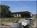
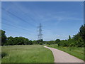
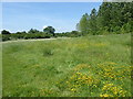
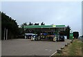
Your daily convenience relies on a cluster of amenities located just outside the immediate residential core. Retail options are immediately accessible, with five major stores serving shoppers in the wider area. You will frequently visit M&S Hornchurch BP, Tesco Hornchurch, and Co-op Harold for groceries and household necessities. These retailers handle most standard shopping requirements without the need for long commits to city centres. Transport convenience is woven into the lifestyle fabric with five nearby railway stations. Harold Wood, Emerson Park, and Gidea Park offer national rail services, while Upminster Bridge, Hornchurch, and Elm Park provide Underground access. This network density allows you to choose your preferred mode of travel based on your daily schedule. While the 2973 square metre size of the postcode limits local park space within the specific boundary, the proximity to larger stations connects you to broader recreational zones. The presence of these stations often encourages walking or cycling for short station-access trips. Your leisure time can be spent locally or utilise the rapid rail links to explore East London attractions. The layout supports a car-light lifestyle, as the station clusters are designed to be accessible from residential streets.
Amenities
Schools
| Rank | School | Type | Entry gender | Ages |
|---|
Explore more schools in this area
Go to Schools tabDemographics
The social fabric of RM11 3ET is heavily influenced by established homeownership. An impressive 86% of residents own their homes, which points to a stable, long-term community invested in the locality. This high ownership rate typically correlates with a slower-paced environment where residents often stay for decades. Houses dominate the accommodation types, confirming this is a traditional suburban setting rather than a city centre flat market. The demographic profile leans heavily towards adults between 30 and 64 years old, with a median age of 47 years. This indicates the area may appeal to families raising children or professionals in the mid-career stage. Ethnic diversity is primarily White, reflecting the broader historical development of the Hornchurch corridor. Your neighbours are likely deeply embedded in the area, having purchased property during previous housing market cycles. The concentration of older residents and families suggests a demand for space and garden access rather than low-rise apartments. This demographic stability often leads to consistent community standards and a predictable daily rhythm. The population density sits at 624,582 people per square kilometre, a figure driven by the very small total area size of 2973 square metres. Despite this statistical density, the actual lived experience feels sparse due to the residential focus.
Household Size
Accommodation Type
Tenure
Ethnic Group
Religion
Household Composition
Age
Household Deprivation
NS-SEC
Explore more demographic insights in this area
Go to Demographics tabPlanning
Planning Constraints
- Flood RiskPremium
- Ramsar Wetland SitesPremium
- Area of Outstanding Natural BeautyPremium
- Protected Nature ReservePremium
- Protected WoodlandPremium