Area Overview for RM11 3UJ
Photos of RM11 3UJ
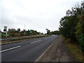
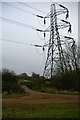
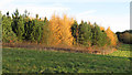
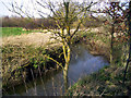
20 photos from this area
Area Information
Key information about the RM11 3UJ including its size, population, and administrative classification.
- Area Type
- Postcode
- Area Size
- 22.0 hectares
- Population
- 1488
- Population Density
- 1758 people/km²
House Prices in RM11 3UJ
9
Properties
£750,000
Average Sold Price
£750,000
Lowest Price
£750,000
Highest Price
Showing 9 properties
| Address | Type | Beds | Baths | Last Sale Price | Last Sale Date | |
|---|---|---|---|---|---|---|
| Staff Quarters At Palm Hotel, Southend Arterial Road, Hornchurch, RM11 3UJ | Flat | - | - | £750,000 | Nov 2020 | |
| The Bowery, 251 Southend Arterial Road, Hornchurch, RM11 3UJ | Detached | - | - | - | - | |
| Sunset, 253 Southend Arterial Road, Hornchurch, RM11 3UJ | Detached | - | - | - | - | |
| Mount Pleasant Farm, Southend Arterial Road, Hornchurch, RM11 3UJ | Farm | - | - | - | - | |
| Caravan, Sunset, 253 Southend Arterial Road, Hornchurch, RM11 3UJ | Mobile Home | - | - | - | - | |
| Hornchurch Connect, Southend Arterial Road, Hornchurch, RM11 3UJ | Retail | - | - | - | - | |
| B P Connect, Southend Arterial Road, Hornchurch, RM11 3UJ | Retail | - | - | - | - | |
| Atm, Bp Connect Garage, Southend Arterial Road, Hornchurch, RM11 3UJ | Retail | - | - | - | - | |
| Marks And Spencer, B P Connect, Southend Arterial Road, Hornchurch, RM11 3UJ | shop | - | - | - | - |
Energy Efficiency in RM11 3UJ
Amenities
Schools
| Rank | School | Type | Entry gender | Ages |
|---|
Explore more schools in this area
Go to Schools tabDemographics
Household Size
Family (3-5 people)
most common
Accommodation Type
Houses
most common
Tenure
83
majority
Ethnic Group
White
most common
Religion
N/A
most common
Household Composition
N/A
most common
Age
47
median
Adults (30-64 years)
most common
Household Deprivation
N/A
with no deprivation
NS-SEC
36
in Lower managerial occupations
Explore more demographic insights in this area
Go to Demographics tabPlanning
Planning Constraints
- Flood RiskPremium
- Ramsar Wetland SitesPremium
- Area of Outstanding Natural BeautyPremium
- Protected Nature ReservePremium
- Protected WoodlandPremium