Area Overview for RM11 1LR
Photos of RM11 1LR
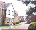
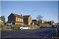
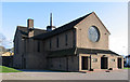
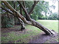
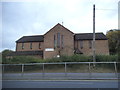
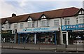
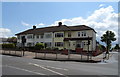
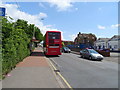
21 photos from this area
Area Information
Key information about the RM11 1LR including its size, population, and administrative classification.
- Area Type
- Postcode
- Area Size
- 1.2 hectares
- Population
- 1861
- Population Density
- 4927 people/km²
House Prices in RM11 1LR
32
Properties
£284,852
Average Sold Price
£74,000
Lowest Price
£525,000
Highest Price
Showing 32 properties
| Address | Type | Beds | Baths | Last Sale Price | Last Sale Date | |
|---|---|---|---|---|---|---|
| 47 Bush Elms Road, Hornchurch, RM11 1LR | Semi-detached | 3 | 1 | £525,000 | Nov 2023 | |
| 45 Bush Elms Road, Hornchurch, RM11 1LR | house | - | - | £450,000 | Sep 2023 | |
| 11 Bush Elms Road, Hornchurch, RM11 1LR | house | - | - | £417,000 | Jun 2021 | |
| 41 Bush Elms Road, Hornchurch, RM11 1LR | house | - | - | £480,000 | Mar 2021 | |
| 63 Bush Elms Road, Hornchurch, RM11 1LR | Semi-detached | 3 | 1 | £435,000 | Sep 2019 | |
| 1 Bush Elms Road, Hornchurch, RM11 1LR | Terraced | 3 | 1 | £418,250 | Mar 2019 | |
| 39 Bush Elms Road, Hornchurch, RM11 1LR | house | 3 | 1 | £405,000 | Jul 2016 | |
| 55 Bush Elms Road, Hornchurch, RM11 1LR | house | - | - | £375,000 | Oct 2015 | |
| 57 Bush Elms Road, Hornchurch, RM11 1LR | Semi-detached | 3 | 1 | £345,000 | Aug 2015 | |
| 23 Bush Elms Road, Hornchurch, RM11 1LR | Terraced | 3 | - | £261,000 | Oct 2013 |
Page 1 of 4
Energy Efficiency in RM11 1LR
Amenities
Schools
| Rank | School | Type | Entry gender | Ages |
|---|
Explore more schools in this area
Go to Schools tabDemographics
Household Size
Family (3-5 people)
most common
Accommodation Type
Houses
most common
Tenure
68
majority
Ethnic Group
White
most common
Religion
N/A
most common
Household Composition
N/A
most common
Age
47
median
Adults (30-64 years)
most common
Household Deprivation
N/A
with no deprivation
NS-SEC
32
in Lower managerial occupations
Explore more demographic insights in this area
Go to Demographics tabPlanning
Planning Constraints
- Flood RiskPremium
- Ramsar Wetland SitesPremium
- Area of Outstanding Natural BeautyPremium
- Protected Nature ReservePremium
- Protected WoodlandPremium