Area Overview for NW6 6SE
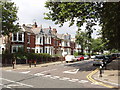
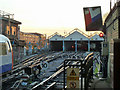
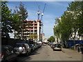
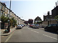
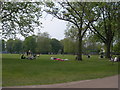
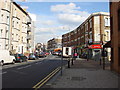
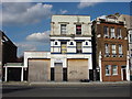
Photos of NW6 6SE

Area Information
Postcode NW6 6SE represents a specific residential cluster within the London Borough of Westminster, covering a total area of just 417 square metres. This small footprint supports a population of 2,049 residents, creating a dense, concentrated living environment. The area is defined by its compact nature, where daily necessities and neighbours are in immediate proximity. Living in NW6 6SE means navigating a space where population density reaches approximately 4.9 million people per square kilometre, a figure that reflects the intense urban character of this postcode. You will find yourself in a setting where every plot is utilised, and the boundary between public and private space is often blurred. The high concentration of residents results in a neighbourhood where community interaction is frequent but space is at a premium. This postcode is not a sprawling suburb; it is a tight-knit block of apartments and homes where convenience is the primary architectural feature. Understanding the scale of NW6 6SE is essential for anyone considering buying a home here, as it dictates the pacing of daily life. The area functions as a micro-city, where the limited land area maximises access to services while maintaining a distinct residential identity within the wider NW6 neighbourhood.
- Area Type
- Postcode
- Area Size
- 417 m²
- Population
- 2049
- Population Density
- 10497 people/km²
The property market in NW6 6SE is characterised by a distinct reliance on flats as the main form of accommodation. With home ownership standing at just 43%, the housing stock reflects a balanced but slightly tenant-heavy environment. This lower level of ownership is typical for areas with high density and limited land availability, where flats often dominate the skyline. For buyers looking at homes in NW6 6SE, the primary inventory will be apartments rather than detached or semi-detached houses. The 43% ownership rate means that a substantial portion of properties are rented, which influences local rental yields and investment potential. The small total area of 417 square metres confines the building footprint, further reinforcing the prevalence of vertical living solutions. You are likely to find that most inventory consists of purpose-built flats or converted upper sections of multi-storey residential blocks. This market structure suits those seeking low-maintenance living without the need for extensive grounds or large private gardens. The density means that land value is concentrated, making flats the logical economic choice for development and purchase. Whether you are an investor or a first-time buyer, the flat-centric nature of this postcode dictates the nature of your search. The area does not offer a traditional single-family home market, so buyer expectations must align with the realities of high-density urban living.
House Prices in NW6 6SE
No properties found in this postcode.
Energy Efficiency in NW6 6SE
Daily life in NW6 6SE is supported by an extensive array of amenities located within practical reach of your doorstep. Public transport options are plentiful, with five rail stations nearby, including Queen's Park Station, Brondesbury Park Station, and Kensal Rise Station. Metro services are equally accessible through five stations such as Kilburn Park, Kilburn, and Maida Vale. The area is also served by three bus routes, with significant connections to London Victoria Coach Station and the Green Line. For those preferring a scenic route, five waterbus stops provide access to spots like Little Venice, London Zoo, and Camden Lock. Retail convenience includes major high-street names such as M&S Queens, Co-op Queens, and Sainsburys Queens all situated nearby. These five retail outlets ensure that daily errands can be completed without travelling far. The presence of Little Venice Waterbus and Camden Lock Waterbus indicates a leisure component to your commute, offering recreational breaks amidst the urban environment. Living in NW6 6SE means having five rail and five metro options at your fingertips, providing redundancy and flexibility for your travel needs. The combination of major coach stations and local supermarkets creates a self-sufficient environment where work and leisure are balanced. You can access diverse shopping and dining without relying solely on private vehicles. The proximity to these specific venues enhances the convenience of everyday living, making NW6 6SE a convenient base for navigating the wider city.
Amenities
Schools
| Rank | School | Type | Entry gender | Ages |
|---|
Explore more schools in this area
Go to Schools tabDemographics
The community within NW6 6SE is dominated by an adult demographic, with a median age of 47 years. Adults between the ages of 30 and 64 constitute the most common age range, indicating a population that is generally in the prime of their careers and families. Home ownership stands at 43%, suggesting that the area contains a mix of owner-occupiers and tenants, though a significant portion of residents have a stake in their property. The predominant form of accommodation consists of flats, which aligns with the high population density and the limited area size of the postcode. While the area is predominantly White, the residential mix supports a diverse range of household types suited to the flat living profile. This demographic profile paints a picture of a mature community where long-term residents often outnumber transient populations. The fact that nearly half of the residents own their homes suggests a level of stability and investment in the neighbourhood. Shopping homes in NW6 6SE often appeals to these older adults or those valuing the flat-style living that matches the demographic's lifestyle needs. The absence of data on deprivation means we must rely on the age and ownership statistics to gauge the area's character. A community where the largest group are adults can imply quieter evenings and a different type of local engagement compared to areas with younger populations.
Household Size
Accommodation Type
Tenure
Ethnic Group
Religion
Household Composition
Age
Household Deprivation
NS-SEC
Explore more demographic insights in this area
Go to Demographics tabPlanning
Planning Constraints
- Flood RiskPremium
- Ramsar Wetland SitesPremium
- Area of Outstanding Natural BeautyPremium
- Protected Nature ReservePremium
- Protected WoodlandPremium