Area Overview for NW6 6JX
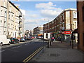
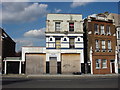
Photos of NW6 6JX


Area Information
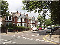
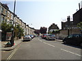
Living in NW6 6JX places you within a compact residential cluster in North West London. This postcode covers an area of 5152 square metres and serves a population of 2049 people. The density figures suggest the space is utilised efficiently, creating a neighbourhood where residents are close to one another without the sprawl found in other districts. Life here moves at a pace typical of the wider Kensal Green and Maida Vale districts. You will find a setting defined by its residential focus rather than industrial or heavy commercial activity. The area functions as a self-contained community where daily needs are met without requiring long journeys. Prospective buyers should note the specific constraints of this postcode. It is a small footprint compared to larger borough averages. This means that while you gain proximity to significant transport hubs, your immediate surroundings remain intimate. The demographic profile indicates a mature community rather than a young student population. You are entering an established environment where the character of the neighbourhood has developed over many years. Every house and flat within these 5000 square metres contributes to the local identity. Understanding the physical scale of NW6 6JX helps you appreciate the exclusivity of the address while recognising the density of nearby urban infrastructure.
- Area Type
- Postcode
- Area Size
- 5152 m²
- Population
- 2049
- Population Density
- 10497 people/km²
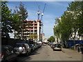
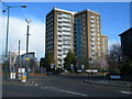
The property market in NW6 6JX is defined by a specific balance of ownership and rental sectors. With home ownership at 43%, the area presents a mixed market where you have viable options for both buyers and landlords. This ownership rate is significant enough to suggest that many dwellings have passed through multiple generations of families. However, the majority of the stock is rented, indicating a steady demand from professionals and retirees who prefer flexibility. Widely, the accommodation type in this postcode is flats. This is the dominant form of housing you will encounter when viewing properties in NW6 6JX. Flats are particularly suited to the urban environment found in the vicinity of Finchley Road and Kilburn High Road. You will find fewer detached or semi-detached houses here compared to other postcodes in the NW6 area. The flat market offers immediate access to the local amenities without the need for a car. For those considering homes in NW6 6JX, focus your searches on converted blocks or purpose-built flats near the rail stations. The 5152 square metre size limit of the postcode itself constrains new build developments, protecting the character of existing blocks.
House Prices in NW6 6JX
Showing 17 properties
| Address | Type | Beds | Baths | Last Sale Price | Last Sale Date | |
|---|---|---|---|---|---|---|
| 3 Dudley Road, London, NW6 6JX | Terraced | 3 | 1 | £900,000 | Apr 2023 | |
| 10 Dudley Road, London, NW6 6JX | Terraced | 4 | 2 | £2,000,000 | Feb 2023 | |
| 7 Dudley Road, London, NW6 6JX | Terraced | 4 | 3 | £2,080,000 | Aug 2022 | |
| 4 Dudley Road, London, NW6 6JX | Terraced | 3 | 1 | £2,250,000 | Sep 2021 | |
| 2 Dudley Road, London, NW6 6JX | Terraced | 3 | - | £1,595,000 | Sep 2020 | |
| 9 Dudley Road, London, NW6 6JX | Terraced | 4 | 2 | £1,565,000 | Jul 2020 | |
| 1 Dudley Road, London, NW6 6JX | house | - | - | £990,000 | Jul 2010 | |
| 11 Dudley Road, London, NW6 6JX | Terraced | - | - | £675,000 | Apr 2006 | |
| 12 Dudley Road, London, NW6 6JX | Semi-detached | 3 | 1 | £666,250 | Sep 2005 | |
| 5 Dudley Road, London, NW6 6JX | Terraced | 4 | 3 | £110,000 | Jul 1997 |
Energy Efficiency in NW6 6JX
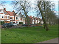
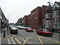
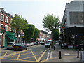
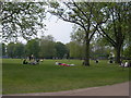
Your lifestyle in NW6 6JX is defined by immediate access to comprehensive amenities. You do not need a car to reach essential shops, dining venues, or leisure facilities. Retail convenience is high within the immediate neighbourhood. You can visit M&S Queens, Co-op Queens, and Sainsburys Queens for your weekly shopping. These supermarkets are clustered nearby, reducing the time spent on groceries. Five retail options ensure that you can compare prices and quality without travelling far. Transport connectivity also supports a diverse lifestyle. You have access to five rail stations and five metro stations. Notable stops include Queen's Park Station, Brondesbury Park Station, and Kensal Rise Station for commuters. For leisure, the Little Venice Waterbus Stop and Camden Lock Waterbus offer evening excursions. Educational transport is supported by five bus routes, though the notable list for buses includes major coach stations like London Victoria Coach Station, reflecting the wider network connectivity. Parks and green spaces are nearby, aligning with the general character of the Kensal Green and Maida Vale districts. The presence of multiple stations means you can reach different parts of London for culture, dining, or work without delay. This density of transport and retail creates a convenient urban living experience.
Amenities
Schools
| Rank | School | Type | Entry gender | Ages |
|---|
Explore more schools in this area
Go to Schools tabDemographics
The community in NW6 6JX reflects a settled lifestyle rather than a transient one. The median age is 47, indicating that most residents have established careers and are likely raising families or enjoying retirement. The most common age range falls between 30 and 64 years old. This demographic split creates a stable neighbourhood where neighbours know each other by name. You are unlikely to find high turnover rates typical of student accommodation zones. The population composition is predominantly White, which aligns with the historic character of the North West London area. Home ownership stands at 43%, meaning nearly half of the residents own their homes outright or with a mortgage. The remaining half likely resides in rentals or shared ownership schemes. The predominant accommodation type within this postcode is flats. This is a crucial detail for buyers seeking houses to renovate or those requiring large gardens. Instead, the housing stock focuses on interior living spaces. Flats offer convenience and proximity to the tube stations without the maintenance responsibilities of Victorian terraced houses. The high proportion of older adults combined with the prevalence of flats suggests a location favouring accessibility and convenience over suburban space.
Household Size
Accommodation Type
Tenure
Ethnic Group
Religion
Household Composition
Age
Household Deprivation
NS-SEC
Explore more demographic insights in this area
Go to Demographics tabPlanning
Planning Constraints
- Flood RiskPremium
- Ramsar Wetland SitesPremium
- Area of Outstanding Natural BeautyPremium
- Protected Nature ReservePremium
- Protected WoodlandPremium