Area Overview for NW6 5NJ
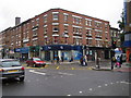
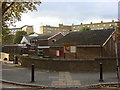
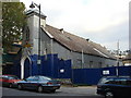
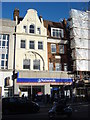
Photos of NW6 5NJ


Area Information
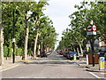
Living in NW6 5NJ means residing within a defined residential cluster that spans just 2,185 square metres. This small postcode area serves roughly 2,085 residents, creating a high-density environment where space is at a premium. You are situated in a specific part of north-west London that functions more as a tightly packed urban settlement than a sprawling suburb. The sheer concentration of people relative to the land size suggests a lively neighbourhood where foot traffic is high and community interactions happen frequently on shared pavements and streets. Daily life here is shaped by the proximity to major transport arteries and shopping districts. You live in close quarters, which means noise levels can vary. Yet, the location offers immediate access to Kilburn High Road and other key routes. The area's identity is tied to its function as a dense housing block rather than a wide-open leisure space. Understanding the scale of this postcode is essential, as 2,085 people sharing 2,185 square metres indicates a very compact living experience. This is a place defined by its intensity and its connection to the broader Kilburn and Hampstead corridors. The neighbourhood operates with the rhythm of a busy city pocket rather than a quiet village.
- Area Type
- Postcode
- Area Size
- 2185 m²
- Population
- 2085
- Population Density
- 17943 people/km²
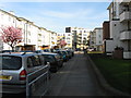
The property market in NW6 5NJ is characterised by a heavy reliance on private and social renting. With only 15% of households owning their homes, the area functions primarily as a rental market. If you are looking to buy a freehold property here, you will find limited options. The housing stock is overwhelmingly composed of flats, a direct result of the limited land area available to this 2,185 square metre postcode. This lack of owner-occupied housing suggests that many residents may move frequently or face long-term uncertainty regarding their accommodation stability. Flat living in a high-density area often implies shared building corridors and external communal responsibilities. For a buyer, the command of "homes in NW6 5NJ" effectively reduces the search to rental acquisitions or very rare share-of-freehold arrangements. The 85% tenant rate reshapes the entire local economy towards letting agents rather than estate sales. You should not expect the traditional English suburban model of family homes and large gardens in this specific cluster. The accommodation type data confirms a vertical living arrangement. This density suits the demographic of adults but leaves little room for the single-family home buyer. The market dynamics here are distinct from neighbouring postcodes with higher ownership rates. Your focus must be on managing leasehold terms rather than freehold maintenance. The high concentration of rental units defines the immediate surroundings of this postcode zone.
House Prices in NW6 5NJ
Showing 22 properties
Energy Efficiency in NW6 5NJ
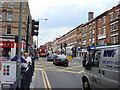
Your lifestyle in NW6 5NJ is defined by immediate access to major retail hubs and transport interchange points. Shops such as Tesco High, M&S Kilburn SF, and Sainsburys Kilburn are within practical reach for your daily grocery and household needs. Dining and fashion choices are abundant nearby. The real strength of this location, however, lies in the transport clusters just outside your postcode boundary. You have five railway stations within easy access, including Queen's Park Station and South Hampstead Station. Another five metro stops serve the area, with St John's Wood Station and Maida Vale Station offering direct routes into the city centre. The bus network links you to major coach stations. Furthermore, the water side offers recreation with the Little Venice Waterbus Stop and London Zoo Waterbus Stop. You can reach all these facilities without a private vehicle. This density of amenities creates a convenient, car-free existence. The variety of retail and transit options surrounds you, ensuring that a lack of private space indoors is balanced by a rich external environment.
Amenities
Schools
| Rank | School | Type | Entry gender | Ages |
|---|
Explore more schools in this area
Go to Schools tabDemographics
The community within NW6 5NJ is dominated by adults aged between 30 and 64 years. This is not a teenage district nor is it primarily for the very young or the elderly. The median age of 47 confirms that the population consists largely of established families or individuals building stable lives in this location. With 85% of the 2,085 residents falling into the adult working and retirement years, the local services cater to a mature demographic. Home ownership in this specific postcode is low, with only 15% of households owning their home outright. This figure indicates that the vast majority of residents are tenants. You are likely to encounter a high proportion of renters rather than landlord occupants. The dominant accommodation type is the flat, which aligns perfectly with the high density and limited land area of the 2,185 square metre zone. Flats provide the necessary efficiency for a large number of people living in close proximity. The predominant ethnic group is White, reflecting the wider demographic trends of northern London. This area does not present as a highly diverse enclave but rather fits the general statistical profile of the region. The age structure and ownership statistics paint a picture of a working-middle-class rental market. Most of the 30-64 year olds are navigating life as renters within a building stock consisting almost entirely of flats. This demographic profile offers a sense of stability through age but less long-term security in terms of property possession.
Household Size
Accommodation Type
Tenure
Ethnic Group
Religion
Household Composition
Age
Household Deprivation
NS-SEC
Explore more demographic insights in this area
Go to Demographics tabPlanning
Planning Constraints
- Flood RiskPremium
- Ramsar Wetland SitesPremium
- Area of Outstanding Natural BeautyPremium
- Protected Nature ReservePremium
- Protected WoodlandPremium