Area Overview for NW6 5FU
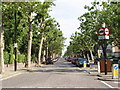
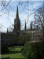
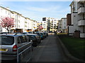
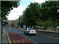
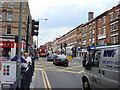
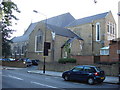
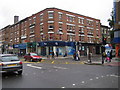
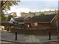
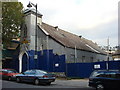
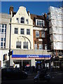
Photos of NW6 5FU


Area Information
Living in NW6 5FU places you within a specific residential cluster defined by its precise postcode. This small area covers just 5973 square metres, yet it accommodates a population of 1953 people. The resulting population density reaches an extraordinary 326993 people per square kilometre, reflecting the compact nature of this London location. For those considering homes in this postcode, the proximity to major infrastructure is immediate. You are situated close to Kilburn Park Station, Maida Vale Station, and several high road and rail hubs that connect you quickly to the rest of the capital. Daily life here revolves around convenient access to retail giants such as Tesco High and M&S Kilburn SF, alongside the unique convenience of the Little Venice Waterbus Stop. The space is characterised by high-density living rather than sprawling estates. While the physical area is small, the connectivity to points like Camden Lock and London Zoo Waterbus Stop ensures you remain well-serviced. This environment suits individuals who value immediate access to amenities and rapid public transport links over large plots of land.
- Area Type
- Postcode
- Area Size
- 5973 m²
- Population
- 1953
- Population Density
- 15151 people/km²
The property market within NW6 5FU is heavily weighted towards rented accommodation due to a home ownership rate of just 24 per cent. Approximately three quarters of residents do not own their homes, suggesting a robust private rental sector dominates this postcode. The structure of the housing stock reflects this, as flats serve as the predominant type of accommodation. For you, a prospective buyer, this means that purchased freehold properties within this specific 5973 square metre cluster may be less common than leasehold flats or ground rents. The high density of 326993 people per square kilometre further reinforces the prevalence of shared living spaces and upper or lower floors within buildings. While there is minority owner-occupied stock, the market character is distinctly that of a rental hub. Families or individuals seeking to buy should look closely at the available leasehold options that cater to this flat-heavy environment. Understanding that you are entering an area where most neighbours rent their flats can influence your expectations regarding community cohesion and building management.
House Prices in NW6 5FU
Showing 72 properties
Energy Efficiency in NW6 5FU
Your lifestyle in NW6 5FU is defined by immediate access to a dense network of retail and transport options. You have five notable retail choices, including Tesco High, M&S Kilburn SF, and Sainsburys Kilburn, ensuring your grocery and shopping needs are met with ease. Public transport availability is vast, with five metro stations nearby, including Kilburn Park, Maida Vale, and St John's Wood. Additionally, five rail stations such as Kilburn High Road and Queen's Park offer frequent journeys across the network. For diverse travel preferences, five waterbus stops like Little Venice and Camden Lock provide river access, while bus routes connect you to major hubs like London Victoria Coach Station. This concentration of amenities within practical reach means you spend less time commuting for daily tasks. You can walk to local shops or take a waterbus directly to leisure spots like London Zoo. The area supports a fast-paced city life where convenience is built into the geography of the postcode.
Amenities
Schools
Families considering schools near NW6 5FU have access to a mix of state and independent provision within practical reach. St Augustines Federated Schools: CofE Primary School is available for younger children and holds a satisfactory Ofsted rating. Nearby families also have access to St Augustine's Federated Schools: CE High School, which carries a good Ofsted rating. According to the data, a Naima Jewish Preparatory School operates in the vicinity as an independent option. This selection offers a blend of faith-based education with strong performance metrics alongside independent schooling. The presence of both primary and high school-level institutions suggests the area supports dependent children well. While the data does not include further education colleges or universities specifically named for this postcode, the available primary and secondary choices provide a solid foundation for varied educational philosophies. Parents can choose between the state sector options with specific ratings or the independent track provided by the Jewish preparatory school. The variety allows families to match their specific educational values with the performance standards observed by Ofsted.
| Rank | School | Type | Entry gender | Ages |
|---|
Explore more schools in this area
Go to Schools tabDemographics
The community in NW6 5FU is defined by an established age profile, with a median age of 47 years. Adults between the ages of 30 and 64 represent the most common age range, indicating a neighbourhood populated by mature individuals and families rather than young professionals just entering the market. Only 24 per cent of residents own their homes, which signals that the majority of the population rents rather than owns their property. This low home ownership rate aligns with the area's predominant accommodation type, which consists largely of flats. The population is not homogeneous, though White residents make up the predominant ethnic group. Given the high density, the area functions as a shared living space for a broad demographic. The concentration of adults suggests a stable community where long-term residents likely mingle with families and professionals nearing or passing through different life stages. This demographic mix creates a specific dynamic where household interventions and services are geared towards a mature, primarily renting population living in flat properties.
Household Size
Accommodation Type
Tenure
Ethnic Group
Religion
Household Composition
Age
Household Deprivation
NS-SEC
Explore more demographic insights in this area
Go to Demographics tabPlanning
Planning Constraints
- Flood RiskPremium
- Ramsar Wetland SitesPremium
- Area of Outstanding Natural BeautyPremium
- Protected Nature ReservePremium
- Protected WoodlandPremium