Area Overview for NW6 4NS
Photos of NW6 4NS


Area Information
Living in NW6 4NS means settling into a compact residential cluster covering just 1,747 square metres yet housing 1,772 people. This density creates a neighbourhood with a high concentration of residents, fostering a close-knit environment where daily life moves quickly. The area functions as a specific postcode zone within a larger urban fabric, offering numerous transport options despite its small physical footprint. Your daily commute likely involves one of the many nearby rail or metro stations, as the surrounding infrastructure links you directly to central London and beyond. The character of this small area is defined by its practical accessibility rather than extensive green spaces or lone grand estates. You will find yourself surrounded by a community where proximity is key. The location sits near major thoroughfares and stations like Kilburn High Road, meaning you rarely need to travel far for essential services or leisure activities. While the area is small, its connectivity compensates for the limited land, making it a viable and convenient base for professionals working in the city or looking for a flat-centric lifestyle in North West London. The sheer number of people per square kilometre suggests a vibrant, busy atmosphere rather than quiet isolation.
- Area Type
- Postcode
- Area Size
- 1747 m²
- Population
- 1772
- Population Density
- 16257 people/km²
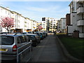
The property market in NW6 4NS is distinctly shaped by accommodation types favouring flats, which dominate the local housing stock. With only 1,747 square metres covering the postcode area, there is no room for sprawling suburban layouts or large detached houses. Instead, the landscape consists of compact living spaces designed for urban density. A mere 31% of residents own their homes, confirming that this is overwhelmingly a rental market. For buyers looking at flats, the high density means you are competing for space in a busy, established built-up area. The low ownership rate suggests that investment properties and buy-to-let landlords hold significant sway in this postcode. You will find more tenants than owners, which typically means higher turnover and potentially greater competition for available rentals. The area appeals to those who prioritise access to transport and amenities over private grounds. When viewing homes in NW6 4NS, focus on the quality of the flat itself rather than the size of the grounds, as the latter are non-existent in this cluster.
House Prices in NW6 4NS
Showing 12 properties
| Address | Type | Beds | Baths | Last Sale Price | Last Sale Date | |
|---|---|---|---|---|---|---|
| 47A Priory Road, London, NW6 4NS | Flat | 3 | 2 | £892,500 | Mar 2023 | |
| Flat A, 41 Priory Road, London, NW6 4NS | Flat | 2 | 2 | - | - | |
| 45 Priory Road, London, NW6 4NS | Semi-detached | 8 | - | - | - | |
| 43 Priory Road, London, NW6 4NS | house | - | - | - | - | |
| 47D Priory Road, London, NW6 4NS | Flat | - | - | - | - | |
| 47B Priory Road, London, NW6 4NS | Flat | - | - | - | - | |
| 47C Priory Road, London, NW6 4NS | Flat | - | - | - | - | |
| Flat C, 41 Priory Road, London, NW6 4NS | Flat | - | - | - | - | |
| Flat D, 41 Priory Road, London, NW6 4NS | Flat | - | - | - | - | |
| Flat E, 41 Priory Road, London, NW6 4NS | Flat | 2 | 2 | - | - |
Energy Efficiency in NW6 4NS
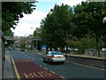
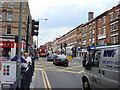
Your daily lifestyle in NW6 4NS revolves around the wealth of amenities accessible within practical reach of the postcode. For shopping essentials, you can visit Sainsburys Camden, Sainsburys Kilburn, or M&S Kilburn SF, all located nearby to meet your retail needs. Transport options are extensive, with five notable rail stations and five metro stations surrounding the area. Kilburn High Road Station, West Hampstead Railway Station, and West Hampstead Overground Station offer frequent train services. Metro connectivity includes Kilburn Park Station, Finchley Road Station, and Swiss Cottage Station, placing you close to major transport arteries. Additionally, three bus stops serve the area, including London Victoria Coach Station Arrivals and Green Line Coach Station for longer journeys. For leisure, the London Zoo Waterbus Stop, Little Venice Waterbus Stop, and Camden Lock Waterbus provide unique water-based access to entertainment and dining. This concentration of services means you can walk or take a short taxi to groceries, cinemas, and restaurants without needing a car.
Amenities
Schools
Families living near NW6 4NS have access to two outstanding-rated primary schools within the immediate vicinity. St Mary's Kilburn Church of England Primary School offers education with the highest possible Ofsted rating, ensuring a high standard of teaching. Similarly, St Eugene de Mazenod Roman Catholic Primary School also holds an outstanding Ofsted rating, providing an alternative for those seeking a Catholic education. The mix of school types available caters to families seeking either a Church of England or a Roman Catholic curriculum, both confirmed by their top-tier regulatory assessments. These institutions serve as key educational anchors for the surrounding residential clusters. When considering homes in NW6 4NS, you can rely on these two establishments being available for young children, as both hold outstanding status. The presence of two rated primary schools nearby indicates a focus on early education quality for the neighbourhood's predominantly adult population.
| Rank | School | Type | Entry gender | Ages |
|---|
Explore more schools in this area
Go to Schools tabDemographics
The community living in NW6 4NS is predominantly made up of adults between the ages of 30 and 64 years old, with a median age of 47. This age profile indicates an area populated by established individuals and families who have settled into long-term residences. House ownership stands at 31%, meaning the majority of residents are likely renting their accommodation. This statistic reflects a dynamic market where properties often change hands frequently between landlords and tenants. The primary accommodation type found here is flats, which aligns with the high population density and the age profile of the residents. These flats cater to professionals and couples seeking convenient urban living close to transport hubs. While the predominant ethnic group in the area is White, the high density and rental nature suggest a diverse mix of individuals drawn to the specific postcode's location. The demographic data paints a picture of a working-age population who value location over large garden spaces. You should expect a community where neighbours are likely peers in their career progression and lifestyle choices, focusing on efficiency and convenience.
Household Size
Accommodation Type
Tenure
Ethnic Group
Religion
Household Composition
Age
Household Deprivation
NS-SEC
Explore more demographic insights in this area
Go to Demographics tabPlanning
Planning Constraints
- Flood RiskPremium
- Ramsar Wetland SitesPremium
- Area of Outstanding Natural BeautyPremium
- Protected Nature ReservePremium
- Protected WoodlandPremium