Area Overview for NW6 4NP
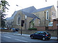
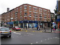
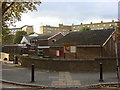
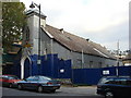
Photos of NW6 4NP


Area Information
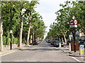
Living in NW6 4NP means residing within a very specific, small residential cluster in north west London. This postcode covers an area of just 3,483 square metres, housing a population of 1,772 people. The density here is exceptionally high, with over 500,000 people per square kilometre recorded in the dataset for this specific location. Residents enjoy immediate access to the Kilburn High Road corridor and its famous tube stations. You are surrounded by major thoroughfares that connect you to the wider capital. Daily life revolves around the high street activities and the proximity of national chain stores and transport hubs. The area is defined by its compact footprint, which creates a dense living environment rather than a sprawling suburb. There are no large green spaces or rural pockets within this single postcode boundary. Instead, you live in one of London's most intense urban pockets where space is at a premium. Your neighbours are largely within walking distance of national rail and Underground networks. This setup suits those who prioritise transit links over open land. The character of the neighbourhood is shaped entirely by the density of the accommodation and the reach of the surrounding tube lines.
- Area Type
- Postcode
- Area Size
- 3483 m²
- Population
- 1772
- Population Density
- 16257 people/km²
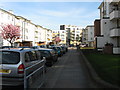
The property market in NW6 4NP is defined by a rental-dominated landscape where tenants outnumber owners significantly. Only 31% of residents own their homes, indicating that 69% of the population rents their accommodation. This high rental percentage suggests the area appeals strongly to investors and private landlords. Flats are the predominant accommodation type within this 3,483 square metre cluster. You will find very few detached or semi-detached houses available in this specific postcode. The housing stock is almost exclusively low-rise apartments or purpose-built blocks typical of Kilburn. This concentration of flats means that residents live in close proximity to their neighbours. The market does not cater primarily to buyers seeking suburban living or large gardens. Instead, it serves those who require urban convenience and access to public transport. Potential buyers looking for freehold properties in this specific location must expect limited stock. The density of the area supports high rental yields for investors who manage properties here. Home purchase options are narrower compared to areas with higher ownership percentages. The dominance of flats offers security of tenure through tenancy agreements for the majority of households.
House Prices in NW6 4NP
Showing 19 properties
| Address | Type | Beds | Baths | Last Sale Price | Last Sale Date | |
|---|---|---|---|---|---|---|
| 6 Abbots Place, London, NW6 4NP | house | - | - | £2,500,000 | Mar 2021 | |
| Flat A, 2 Abbots Place, London, NW6 4NP | Flat | - | - | £611,000 | Jul 2018 | |
| 7 Abbots Place, London, NW6 4NP | Land | - | - | £1,125,000 | Aug 2002 | |
| 12 Abbots Place, London, NW6 4NP | Detached | 3 | 2 | - | - | |
| Flat 1ST Floor, 2 Abbots Place, London, NW6 4NP | Flat | 2 | 1 | - | - | |
| 4 Abbots Place, London, NW6 4NP | Maisonette | 2 | 1 | - | - | |
| Crossier Properties Ltd, 4A Abbots Place, London, NW6 4NP | Office | - | - | - | - | |
| Upper Flat, 5 Abbots Place, London, NW6 4NP | Flat | - | - | - | - | |
| Flat 2ND Floor, 3 Abbots Place, London, NW6 4NP | Flat | 3 | 2 | - | - | |
| Flat 2ND Floor, 2 Abbots Place, London, NW6 4NP | Flat | 2 | 2 | - | - |
Energy Efficiency in NW6 4NP
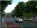
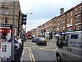
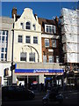
Your lifestyle in NW6 4NP is supported by a dense network of retail and leisure amenities. There are five notable retail venues immediately accessible, including Sainsburys Camden, Sainsburys Kilburn, and M&S Kilburn SF. You can shop for groceries and household goods without travelling beyond the postcode boundary. Travel options are plentiful with five rail, five metro, and five waterbus links identified as nearest amenities. These include Kilburn High Road Station and the iconic London Zoo Waterbus Stop. You do not need a car to access the wider city, as the Kilburn High Road corridor is packed with services. The area also features three major bus routes that connect you to London Victoria Coach Station and the Green Line. Five ferry-like waterbus stops add a unique leisure element to your local environment. Dining and shopping needs are met daily thanks to the concentration of national chains and local independent shops. The mix of supermarkets and station hubs means you can run your errands efficiently. Living in NW6 4NP places you in a commercial ring that functions almost like a small town centre. The convenience of this amenity-rich environment defines the daily rhythm of life in this neighbourhood.
Amenities
Schools
Families living in NW6 4NP have access to two outstanding primary schools within easy reach. St Mary's Kilburn Church of England Primary School holds an outstanding Ofsted rating and is located nearby. St Eugene de Mazenod Roman Catholic Primary School also carries an outstanding Ofsted rating and serves the local community. These institutions provide high-quality education options for children within the area. The presence of both Church of England and Roman Catholic schools indicates a mix of denominational preferences. Both schools have achieved their highest possible rating, suggesting strong academic and pastoral standards. There is data available for primary education provision, but no secondary schools are listed in the provided information. You should verify secondary education options through local council resources for this specific postcode. The excellent ratings of the primary schools make this location attractive for parents seeking top-tierLocal education. The outstanding status of these two institutions stands out in a post-pandemic education landscape. Living in NW6 4NP ensures your children are close to highly rated primary education without needing a comprehensive search for schools near your home. The concentration of high-performing schools in a small postcode is a rare and valuable asset for local families.
| Rank | School | Type | Entry gender | Ages |
|---|
Explore more schools in this area
Go to Schools tabDemographics
The community in NW6 4NP is predominantly made up of adults aged between thirty and sixty-four years. The median age for residents is forty-seven years, reflecting a mature demographic profile. This age range suggests the area attracts families with older children or single professionals who have established themselves. Home ownership stands at 31%, meaning the majority of residents rent their homes. The predominant accommodation type is flats, which aligns with the high-density nature of the postcode. White residents make up the predominant ethnic group within this cluster. The population density figure of 508,755 people per square kilometre indicates an intensely built-up environment typical of central London boroughs. You will find a default level of diversity characteristic of this part of the capital. The lack of ownership registrants points towards a significant private rental sector. This demographic mix creates a stable adult environment with less young family turnover than other London areas. The high proportion of flats supports the lifestyle needs of this age group. Living here offers proximity to amenities without the need for a large garden or detached property.
Household Size
Accommodation Type
Tenure
Ethnic Group
Religion
Household Composition
Age
Household Deprivation
NS-SEC
Explore more demographic insights in this area
Go to Demographics tabPlanning
Planning Constraints
- Flood RiskPremium
- Ramsar Wetland SitesPremium
- Area of Outstanding Natural BeautyPremium
- Protected Nature ReservePremium
- Protected WoodlandPremium