Area Overview for NW6 1QE
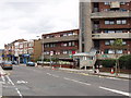
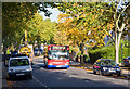
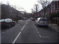
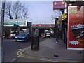
Photos of NW6 1QE


Area Information
Living in NW6 1QE means residing within a compact residential cluster in the London Borough of Camden. The postcode area covers just 1183 square metres yet serves a population of 1582 people. This high density creates an urban environment where residents live close to major transport hubs and amenities without the vast spaces found in suburban districts. The character of the neighbourhood is defined by its flat-packed accommodation and relatively older demographic, with a median age of 47 years. You will find that daily life revolves around the surrounding tube stations and local high streets. Despite the small geographical footprint, the area offers direct access to five National Rail services and five Underground lines. Nearby Kilburn and West Hampstead stations provide quick links to the rest of the capital. You can buy a home here securely, as flood risk assessments indicate a pass with a safety score of zero. There are also no planning constraints related to protected woodlands or nature reserves. This straightforward safety profile makes the location attractive for those who value clarity and low maintenance risks alongside the convenience of city living.
- Area Type
- Postcode
- Area Size
- 1183 m²
- Population
- 1582
- Population Density
- 12967 people/km²
The property market in NW6 1QE is characterised by a balanced split between owner-occupiers and renters. Half of the total households, or 50 per cent, own their properties, indicating a significant portion of the area is composed of residents who have put down roots. The remaining half are likely tenants, creating a dynamic market environment. The predominant accommodation type here is flats, a pragmatic solution for the small land area of 1183 square metres that still houses 1582 individuals. Buyers looking at homes in NW6 1QE should expect a high-rise or multi-unit building environment rather than detached villas. This density supports a vibrant street life as pedestrians access nearby retail outlets. The area does not suffer from flood risks, a crucial factor for anyone purchasing a flat in West London. Safety scores remain low on risk metrics, further enhancing the appeal of owning property here. Whether you are buying a flat or renting one, the location offers excellent connectivity to Kilburn and West Hampstead stations.
House Prices in NW6 1QE
Showing 7 properties
| Address | Type | Beds | Baths | Last Sale Price | Last Sale Date | |
|---|---|---|---|---|---|---|
| 2B Hillfield Road, London, NW6 1QE | Terraced | 4 | 3 | £1,575,000 | Oct 2016 | |
| Former Flat Ground Floor, 2 Hillfield Road, London, NW6 1QE | Flat | - | - | £642,500 | Nov 2015 | |
| 4A Hillfield Road, London, NW6 1QE | Semi-detached | 5 | - | £1,250,000 | Oct 2013 | |
| 2A Hillfield Road, London, NW6 1QE | Terraced | 3 | 2 | £674,000 | Jan 2007 | |
| 4 Hillfield Road, London, NW6 1QE | Flat | 5 | - | £167,500 | Oct 1995 | |
| Dwelling Room 1ST Floor, 2 Hillfield Road, London, NW6 1QE | Semi-detached | 3 | 2 | - | - | |
| Former Flat 1ST Floor, 2 Hillfield Road, London, NW6 1QE | Flat | - | - | - | - |
Energy Efficiency in NW6 1QE
Daily life in NW6 1QE is shaped by immediate access to top-tier shopping and leisure facilities. Within walking distance, you can shop at Tesco Fortune, Waitrose Little, and Tesco Kilburn. These five retail outlets ensure that groceries and daily essentials are always just around the corner. Commuting is effortless with fiveMetro stations and five rail stations nearby. The network includes Kilburn Station, Finchley Road Station, Hampstead Station, West Hampstead Thameslink Railway Station, and Brondesbury Station. Leisure options extend to the water with five ferry services, including the London Zoo Waterbus and Camden Lock Waterbus. While there is no data on parks within the immediate 1183 square metre cluster, the nearby Hampstead Heath is a short walk away. This concentration of Metro, rail, and ferry services means you rarely need a car. Residents can access 3 major bus stations, including London Victoria Coach Station, for longer journeys. Living in NW6 1QE offers a lifestyle defined by convenience and a lack of reliance on private vehicles.
Amenities
Schools
Families living in NW6 1QE have access to quality education through the nearby West Hampstead Primary School. This institution sits at the doorstep of the postcode and holds a 'good' Ofsted rating. It serves as the primary educational option for the local community, catering to the needs of the many children within the area. The school's presence reinforces the status of NW6 1QE as a family-friendly zone despite the urban density. For secondary education, the provided data does not list specific institutions beyond this primary provider. However, the proximity of West Hampstead Primary School suggests a cohort of students moving from this setting to nearby secondary academies. The 'good' rating offers reassurance to parents when discussing education for their children. Living in NW6 1QE means your children have a reputable local school option ready to receive them. This educational anchor is vital for maintaining property values and community stability.
| Rank | School | Type | Entry gender | Ages |
|---|
Explore more schools in this area
Go to Schools tabDemographics
The community in NW6 1QE reflects a mature population structure centred on adults between 30 and 64 years of age. The median age sits at 47 years, confirming that families and established professionals form the backbone of this neighbourhood. Fifty per cent of households own their homes, suggesting a stable, long-term community rather than a transient rental zone. Black residents represent a small minority, with White residents being the predominant ethnic group in this postcode sector. Access to reliable internet is a key feature for this demographic, as most residents likely work from home or require strong connections for remote schooling. Fixed broadband quality reaches a perfect score of 100 out of 100, ensuring uninterrupted service for streaming or business needs. Mobile coverage scores an 85 out of 100, providing excellent connectivity along the high streets. The accommodation type is primarily flats, which suits the high population density of 1,337,547 people per square kilometre. This specific housing style aligns well with the area's central location and the preferences of the current age profile.
Household Size
Accommodation Type
Tenure
Ethnic Group
Religion
Household Composition
Age
Household Deprivation
NS-SEC
Explore more demographic insights in this area
Go to Demographics tabPlanning
Planning Constraints
- Flood RiskPremium
- Ramsar Wetland SitesPremium
- Area of Outstanding Natural BeautyPremium
- Protected Nature ReservePremium
- Protected WoodlandPremium