Area Overview for NW6 1JT
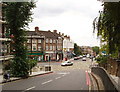
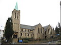
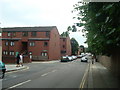
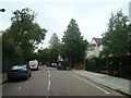
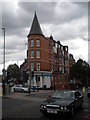
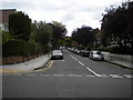
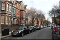
Photos of NW6 1JT


Area Information
NW6 1JT represents a specific residential cluster characterised by distinct housing patterns within West Hampstead. You are looking at a small geographic footprint of just 3254 square metres, yet it supports a population of 1480 people. This creates a highly concentrated living environment. The density here is over 450,000 people per square kilometre, which defines the intensity of daily life in this postcode. Living in NW6 1JT means navigating a space designed for high volumes of residents in a limited physical area. The character of the neighbourhood is shaped by its status as a tightly defined cluster rather than a sprawling district. You will find yourself surrounded by neighbours in a setting that prioritises efficiency and proximity. This specific postcode covers a small area where flat living is the dominant reality. The environment is urban and immediate, offering access to essential services without requiring travel. Your days in NW6 1JT will be defined by the rhythm of a community packed closely together.
- Area Type
- Postcode
- Area Size
- 3254 m²
- Population
- 1480
- Population Density
- 17310 people/km²
The housing stock in NW6 1JT is unique to this small postcode cluster. Flats are the predominant accommodation type, which sets it apart from areas dominated by detached or semi-detached houses. This layout naturally concentrates housing options and influences the overall feel of the neighbourhood. Ownership levels sit at 57%, meaning that just over half of the homes are owner-occupied. This presence of many landlords alongside owner-occupiers creates a mixed market dynamic. You are looking at a market where investment properties play a role alongside family households. The small area size of 3254 square metres reinforces the vertical nature of the housing stock. Most buyers here will be seeking flats rather than traditional ground-floor estates. This concentration means you cannot find a typical suburban garden home in this specific cluster. The market is likely competitive for flats that offer good connectivity to the nearby transport hubs. Understanding the predominance of flats is essential before viewing homes in NW6 1JT.
House Prices in NW6 1JT
Showing 34 properties
Energy Efficiency in NW6 1JT
Your daily life in NW6 1JT benefits from immediate access to a wide range of amenities. Retail options include Waitrose Little, Sainsburys West, and Tesco West. These supermarkets provide fresh groceries and household essentials within practical reach. Transport links are extensive, with five railway stations and five metro stations nearby. You can access West Hampstead Thameslink, West Hampstead Overground, and West Hampstead Railway stations for north London travel. Hampstead Station, Finchley Road Station, and Kilburn Station offer subway connections. Five waterbus stops, including London Zoo Waterbus and Camden Lock Waterbus, provide unique riverside travel options. Bus services connect to London Victoria Coach Station for long-distance railheads. This density of transport modes means you rarely need a car for local trips. Shops and stations are close enough to integrate into your morning routine. Living in NW6 1JT means having your travel and shopping needs met immediately.
Amenities
Schools
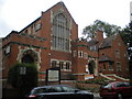
Families considering this postcode have Emmanuel Church of England Primary School as a nearby option. The school holds a good Ofsted rating, which confirms its standard of education. It serves as the primary educational facility identified for children living in the immediate vicinity of NW6 1JT. The limited number of schools listed for this specific postcode area suggests that education resources are concentrated nearby. Parents will rely on this institution for younger children while older students likely commute to larger secondary campuses further away. The good rating of Emmanuel Church of England Primary School provides assurance regarding the quality of early education. This school type represents a chain of schools founded by the Church of England tradition. You should contact the school directly to confirm catchment areas for your specific address in NW6 1JT.
| Rank | School | Type | Entry gender | Ages |
|---|
Explore more schools in this area
Go to Schools tabDemographics
The community profile in NW6 1JT reflects a mature and established population. The median age stands at 47 years, with adults aged between 30 and 64 years forming the most common age range. This suggests an area where families with older children or empty nesters have settled. Home ownership is significant, with 57% of residents owning their homes outright. This figure indicates a stable tenant base rather than a transient rental market. Flats constitute the primary form of accommodation available in this cluster. White residents form the predominant ethnic group, contributing to the area's specific cultural identity. The demographic data points to a neighbourhood where long-term residents plan to stay rather than swap properties frequently. You will find a population that has built ties to this small postcode over many years. The age distribution implies a quiet domestic atmosphere during standard working hours. Understanding these numbers helps you gauge whether the community vibe matches your personal requirements for a home in NW6 1JT.
Household Size
Accommodation Type
Tenure
Ethnic Group
Religion
Household Composition
Age
Household Deprivation
NS-SEC
Explore more demographic insights in this area
Go to Demographics tabPlanning
Planning Constraints
- Flood RiskPremium
- Ramsar Wetland SitesPremium
- Area of Outstanding Natural BeautyPremium
- Protected Nature ReservePremium
- Protected WoodlandPremium