Area Overview for NW6 1JS
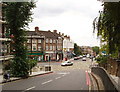
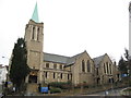
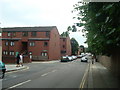
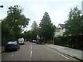
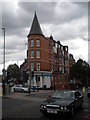
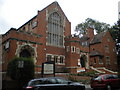
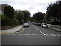
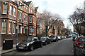
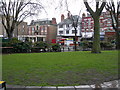
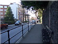
Photos of NW6 1JS


Area Information
NW6 1JS represents a very specific residential cluster in north-west London, covering an area of just 3,531 square metres. This small footprint supports a population of 1,480 people, creating a dense living environment where neighbours share close proximity. The High Croft area is defined by its compact nature, meaning daily activities often unfold within walking distance of home. Residents here experience a high sense of density, with an estimated 419,102 people per square kilometre. This concentration reflects the urban character of the neighbourhood, where living in NW6 1JS means engaging with an intensively populated setting. The area functions as a residential centre rather than a sprawling district, offering convenience at the cost of spatial openness. Life here revolves around the immediate surroundings, with services and transport links accessible without the need for long commutes. You will find that the community is tight-knit due to the limited physical space available for expansion. The postcode serves as a gateway to the broader Finchley and Hampstead districts, yet it maintains its own distinct identity as a concentrated housing development. Expect a lively atmosphere where the boundaries between private gardens and public streets are frequently shared, typical of such high-density urban zones.
- Area Type
- Postcode
- Area Size
- 3531 m²
- Population
- 1480
- Population Density
- 17310 people/km²
The housing market in NW6 1JS is characterised by a high concentration of flats, which dominate the local property stock. With 57% of residents owning their homes, this area leans towards owner-occupation rather than being primarily a rental market. This majority of owner-occupiers suggests stability and a deep-rooted investment in the neighbourhood, influencing local decisions regarding maintenance and community engagement. The dominance of flat accommodation indicates that the local planning history favoured high-density living solutions over sprawling suburban estates. Buyers looking at homes in NW6 1JS should expect modern or converted units designed for vertical living, reflecting the limited 3,531 square metre footprint of the postcode. This housing style appeals to those seeking proximity to amenities without the requirement of large gardens. The balance between ownership and rental suggests a healthy property cycle where landlords coexist with long-term owners. For purchasers, this means a market that values the practical advantages of urban living, such as proximity to transport and shops, over expansive residential land. The high ownership rate also implies that the area has matured beyond initial development phases, offering a settled environment for future moves.
House Prices in NW6 1JS
Showing 35 properties
Energy Efficiency in NW6 1JS
Daily life in NW6 1JS is defined by immediate access to a wide array of amenities within practical reach. Retail options are plentiful, with five notable shops serving local needs, including Waitrose Little, Sainsburys West, and Tesco Fortune. These supermarkets provide everything from daily groceries to household necessities, reducing the need for long shopping trips. Transport connectivity is extensive, with options including West Hampstead Thameslink Railway Station, West Hampstead Overground Station, Finchley Road and Frognal Station, and others listed in the area data. For those preferring the tube, Hampstead Station, Finchley Road Station, and Kilburn Station are nearby, offering rapid links across London. Travel by bus is also convenient, with services connecting to London Victoria Coach Station Arrivals, Green Line Coach Station, and Victoria Coach Station. Leisure activities are equally accessible, featuring five ferry stops such as London Zoo Waterbus Stop, Camden Lock Waterbus, and Little Venice Waterbus Stop. This mix of rail, metro, and water transport creates a dynamic lifestyle where commuting and leisure are seamlessly integrated into daily routines.
Amenities
Schools
Families considering schools near NW6 1JS will find Emmanuel Church of England Primary School as the key local educational provision. This primary institution holds a good Ofsted rating, confirming it meets the expected standards for teaching and care. As a primary school, it serves children from early years up to the age of 11, providing the foundational education required before potential secondary transitions elsewhere. The list of nearby schools is limited in this specific data set, focusing solely on this single primary provider. This concentration suggests that primary education is the main local offering immediately surrounding the postcode. While no secondary schools are listed, the presence of a well-regarded primary school is a significant indicator of the area's suitability for young families. The single school entry highlights a focused educational community where students likely travel to a specific, recognised institution for their lower years. Parents should research the catchment area boundaries carefully, as the proximity indicated by the data does not always guarantee attendance eligibility. The good rating of Emmanuel Church of England Primary School provides reassurance regarding the quality of early education available to children living in this densely populated cluster.
| Rank | School | Type | Entry gender | Ages |
|---|
Explore more schools in this area
Go to Schools tabDemographics
The community within NW6 1JS reflects a mature household structure, with a median age of 47 years. Most residents fall into the adults category, specifically those aged between 30 and 64 years, indicating a strong representation of middle-aged families and established professionals. Home ownership stands at 57%, suggesting that more than half of the population owns their property outright or through a mortgage, while the remainder likely rent or reside with relatives. The prevailing accommodation type is flats, which aligns with the high population density and limited land area available for large detached houses. Ethnic diversity is present but leans heavily towards a White predominant ethnic group, mirroring wider trends in certain north London postcodes. There is no data to suggest a significant proportion of young people under 30, reinforcing the established nature of the demographic. This profile suggests a stable community where long-term residents form the backbone of local society. The high percentage of older adults correlates with the prevalence of flat living, which often offers low-floor accessibility suitable for aging populations. Living here means engaging with a neighbourhood where householders are likely accustomed to city life and the rhythms of a fast-paced urban environment.
Household Size
Accommodation Type
Tenure
Ethnic Group
Religion
Household Composition
Age
Household Deprivation
NS-SEC
Explore more demographic insights in this area
Go to Demographics tabPlanning
Planning Constraints
- Flood RiskPremium
- Ramsar Wetland SitesPremium
- Area of Outstanding Natural BeautyPremium
- Protected Nature ReservePremium
- Protected WoodlandPremium