Area Overview for NW5 3LD
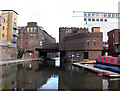
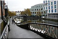
Photos of NW5 3LD


Area Information
NW5 3LD represents a compact residential cluster covering approximately 1014 square metres in NW5. This specific postcode serves 1535 residents, creating a tightly knit neighbourhood where daily life revolves around immediate local resources. You live in a setting defined by high density, with a population figure that suggests a bustling but contained environment. The area is situated within TLDA NW5, offering a slice of life characteristic of north-west London. Daily routines likely involve navigating from your home to nearby transport hubs or local shops quickly. The small footprint of the postcode means everything is within walking distance of the immediate surroundings. Residents here experience a close-knit community feel due to the proximity of homes. You do not need to travel far to reach essential services or leisure spots. This characteristic makes NW5 3LD attractive for those preferring a walkable lifestyle without leaving the locality. The specific nature of this cluster distinguishes it from broader borough statistics. Living here means engaging with a defined group of neighbours and local amenities. The area's identity is rooted in its functional, residential purpose rather than expansive green spaces. You benefit from the concentration of services found within this small geographic boundary. This compact size ensures that your daily path takes you through established parts of NW5. The postcode acts as a gateway to wider transport and retail networks immediately nearby. Your experience of the area is shaped by these efficient, short-distance connections to the rest of London.
- Area Type
- Postcode
- Area Size
- 1014 m²
- Population
- 1535
- Population Density
- 15258 people/km²
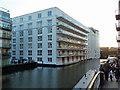
The property market in NW5 3LD is characterised by a distinct dominance of flats, as identified in the accommodation type data. With a home ownership rate of 45 per cent, nearly half of the residents are owners, indicating a significant investment from both private buyers and long-term tenants seeking stability. The remaining 55 per cent reside in rental accommodation, creating a mixed market dynamic. This balance means property values in NW5 3LD respond to both owner-occupier sentiment and rental yield demands. Given the small 1014 square metre footprint of the postcode, the housing stock is likely concentrated in buildings rather than standalone houses. You are more likely to find apartments than detached homes when searching for homes in NW5 3LD. The high population density of 1513883 per square kilometre supports this density-focused construction. Buyers looking in this area should expect vertical living solutions typical of London postcodes. The 45 per cent ownership figure suggests that retaining a portion of the market to first-time buyers or investors remains viable. Rental demand is also robust due to the central location and access to transport. When considering properties in NW5, the flatted style is the norm. You may compete with other investors who recognise the appeal of this postcode for rental income. Home buyers should factor in the implications of shared building maintenance common in flat developments. The mix of owners and renters fosters a dynamic local economy. Property here serves the needs of the 1535 people living within these boundaries. Understanding this split between ownership and tenancy is crucial for anyone entering the NW5 3LD property scene today.
House Prices in NW5 3LD
No properties found in this postcode.
Energy Efficiency in NW5 3LD
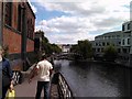
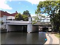
Living in NW5 3LD places you at the heart of a densely supplied retail and transport network. Immediate vicinity includes three major supermarket chains: Tesco Kentish, Co-op Kentish, and Sainsburys Kentish. These venues offer full grocery ranges right outside your front door. For those who travel frequently, rail access is extensive. Five stations serve the route, including Kentish Town West Station, Camden Road Station, and Gospel Oak Station. You can reach central London quickly from your doorstep. Community leisure is accessible via water transport options like the Camden Lock Waterbus and London Zoo Waterbus Stop. The Little Venice Waterbus Stop adds scenic processing to your local journey. Metro connectivity ensures you are never far away; stations such as Chalk Farm Station, Camden Town Station, and Tufnell Park Station are easily reached. Bus services link you to major hubs like London Victoria Coach Station Arrivals and the Green Line Coach Station. This transport web means you can work, shop, or travel without leaving the area. Retail diversity is high with five notable retail locations nearby. You can carry out weekly veg shopping or grab a coffee without using a car. The integration of rail, water, bus, and metro makes NW5 3LD a functional residential hub. Your day-to-day life involves short trips to well-stocked facilities. You benefit from having multiple modes of transport within practical reach. The area supports an active lifestyle with easy access to both shops and stations.
Amenities
Schools
| Rank | School | Type | Entry gender | Ages |
|---|
Explore more schools in this area
Go to Schools tabDemographics
The community in NW5 3LD has a median age of 47 years, reflecting a demographic structure dominated by adults aged between 30 and 64 years. This age profile indicates a mature household population likely consisting of established families or professionals. Home ownership stands at exactly 45 per cent, meaning nearly half of the residents own their property outright or via mortgage. Such a figure suggests a balance between owner-occupiers and retirees residing in the postcode. The accommodation type is predominantly flats, which aligns with the dense construction typical of this urban postcode. This housing style suits the high population density of 1513883 people per square kilometre. The predominant ethnic group is White, representing the primary demographic composition of the area. Diversity exists, but the majority of residents share this background according to available census data. These figures define the social fabric of NW5 3LD. You live among adults with stable careers and family networks. The high population density within such a small 1014 square metre area creates an urban living experience. The age range of 30 to 64 years ensures a steady presence of working-age adults. This demographic stability influences local demand for services and schooling within wider NW5. Home ownership rates above average for older populations suggest long-term settlement. Flat living remains the standard for most households here. The community feels cohesive due to the shared housing type and age group. You engage with neighbours who likely have similar life stages and priorities. The data confirms this area is home to a settled, adult-centric population.
Household Size
Accommodation Type
Tenure
Ethnic Group
Religion
Household Composition
Age
Household Deprivation
NS-SEC
Explore more demographic insights in this area
Go to Demographics tabPlanning
Planning Constraints
- Flood RiskPremium
- Ramsar Wetland SitesPremium
- Area of Outstanding Natural BeautyPremium
- Protected Nature ReservePremium
- Protected WoodlandPremium