Area Overview for NW5 1EE
Photos of NW5 1EE
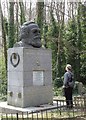
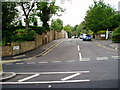
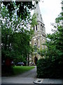
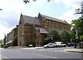
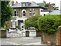
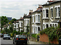
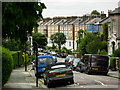
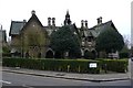
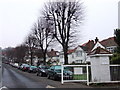
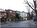
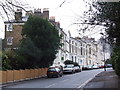
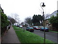
100 photos from this area
Area Information
Key information about the NW5 1EE including its size, population, and administrative classification.
- Area Type
- Postcode
- Area Size
- 6467 m²
- Population
- 1340
- Population Density
- 10292 people/km²
House Prices in NW5 1EE
24
Properties
£2,029,650
Average Sold Price
£225,000
Lowest Price
£3,950,000
Highest Price
Showing 24 properties
| Address | Type | Beds | Baths | Last Sale Price | Last Sale Date | |
|---|---|---|---|---|---|---|
| 13 Boscastle Road, London, NW5 1EE | house | 5 | 2 | £3,950,000 | Sep 2023 | |
| 29 Boscastle Road, London, NW5 1EE | Semi-detached | 5 | 2 | £3,200,000 | Sep 2022 | |
| 5 Boscastle Road, London, NW5 1EE | Flat | 1 | 1 | £3,028,000 | Sep 2021 | |
| 17 Boscastle Road, London, NW5 1EE | Semi-detached | 6 | 2 | £2,750,000 | Nov 2017 | |
| 33 Boscastle Road, London, NW5 1EE | Terraced | 4 | - | £2,387,500 | Oct 2017 | |
| 7 Boscastle Road, London, NW5 1EE | house | 5 | - | £2,650,000 | Nov 2014 | |
| 37 Boscastle Road, London, NW5 1EE | Flat | - | - | £331,000 | Mar 2006 | |
| 27 Boscastle Road, London, NW5 1EE | Flat | - | - | £1,110,000 | Mar 2004 | |
| 25 Boscastle Road, London, NW5 1EE | house | 5 | - | £665,000 | Aug 1999 | |
| 9 Boscastle Road, London, NW5 1EE | house | - | - | £225,000 | Jan 1997 |
Page 1 of 3
Energy Efficiency in NW5 1EE
Amenities
Schools
| Rank | School | Type | Entry gender | Ages |
|---|
Explore more schools in this area
Go to Schools tabDemographics
Household Size
Family (3-5 people)
most common
Accommodation Type
Flats
most common
Tenure
58
majority
Ethnic Group
White
most common
Religion
N/A
most common
Household Composition
N/A
most common
Age
47
median
Adults (30-64 years)
most common
Household Deprivation
N/A
with no deprivation
NS-SEC
63
in Lower managerial occupations
Explore more demographic insights in this area
Go to Demographics tabPlanning
Planning Constraints
- Flood RiskPremium
- Ramsar Wetland SitesPremium
- Area of Outstanding Natural BeautyPremium
- Protected Nature ReservePremium
- Protected WoodlandPremium