Area Overview for NW2 4NH
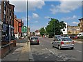
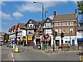
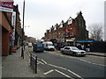
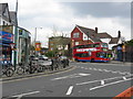
Photos of NW2 4NH


Area Information
Living in NW2 4NH means residing within a compact residential cluster defined by the postcode NW2 4NH. This specific location covers a small land area of 2,585 square metres, yet it houses a dense population of 1,379 people. The resulting population density reaches an extraordinary 533,551 people per square kilometre, indicating a highly urbanised environment typical of inner-city London. Despite this intensity, the postcode serves as a functional hub within the Greater London area. Daily life here revolves around the immediate onset of city living rather than suburban sprawl. You will find the property postcode NW2 4NH embedded in a setting where space is at a premium. The small physical footprint means fewer large gardens and more shared living environments. Residents here experience the speed and convenience of a central location while dealing with the constraints of urban density. This area represents a specific slice of the NW2 network, catering to those who prioritise proximity to transport and amenities over open space. Understanding the scope of this postcode is essential for anyone evaluating homes in NW2 4NH. The layout is tightly packed, reflecting the broader planning principles of this central London postal district.
- Area Type
- Postcode
- Area Size
- 2585 m²
- Population
- 1379
- Population Density
- 12086 people/km²
The property market in NW2 4NH is defined by a clear dominance of rental living over home ownership. With 69% of residents renting, the area serves more as a housing choice for those seeking flexibility than a destination for long-term owner-occupation. This statistic leaves only 31% of households as owner-occupied, making it a distinctly tenant-friendly locality. Accommodation types in homes in NW2 4NH are primarily flats. This architectural preference stems directly from the constrained land size of 2,585 square metres. You will encounter multiple smaller units stacked vertically rather than sprawling single-family homes. This housing stock is built to maximise occupancy within a minimal footprint, catering to the high population density of 533,551 people per square kilometre. For buyers evaluating this postcode, the lack of owner-occupiers suggests a competitive rental market. If you intend to purchase, you may find more properties on the buy-to-let or second-hand market in adjacent areas than directly within this small cluster. The flat-based design means buyers often look for shared amenity access rather than private outdoor space. Understanding this market dynamic is crucial for anyone navigating the homes in NW2 4NH.
House Prices in NW2 4NH
Showing 15 properties
| Address | Type | Beds | Baths | Last Sale Price | Last Sale Date | |
|---|---|---|---|---|---|---|
| 12A Station Parade, London, NW2 4NH | Flat | - | - | £600,000 | Mar 2025 | |
| 26A Station Parade, London, NW2 4NH | Flat | 1 | - | £144,000 | Jun 2011 | |
| 22A Station Parade, London, NW2 4NH | Flat | - | - | £117,000 | Nov 1999 | |
| Former, 14A Station Parade, London, NW2 4NH | Flat | - | - | - | - | |
| Former, 12A Station Parade, London, NW2 4NH | Flat | - | - | - | - | |
| 16A Station Parade, London, NW2 4NH | Flat | 3 | - | - | - | |
| 20A Station Parade, London, NW2 4NH | Flat | - | - | - | - | |
| 18A Station Parade, London, NW2 4NH | Flat | - | - | - | - | |
| 24A Station Parade, London, NW2 4NH | Flat | - | - | - | - | |
| 26B Station Parade, London, NW2 4NH | Flat | - | - | - | - |
Energy Efficiency in NW2 4NH
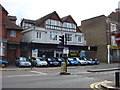
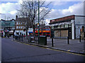
Life in NW2 4NH offers immediate access to essential services and leisure venues, all within practical reach. You will find five retail options nearby, notably at Co-op Willesden, Sainsburys Willesden, and a second Sainsburys location. These supermarkets ensure you can resolve daily grocery needs without travelling far from your doorstep. Leisure and movement are also supported by extensive transport links. Five railway stations, including Cricklewood and Brondesbury Park, put major commuting cores nearby. Five metro stops, such as Kilburn and Neasden, provide busy underground connections. For those preferring scenic routes, five ferry stops including Little Venice Waterbus and Camden Lock offer unique escapes. Furthermore, three bus services, including connections to London Victoria Coach Station, expand your mobility options. This amenity density transforms NW2 4NH from a quiet postcode into a convenient transport and shopping hub. The concentration of shops and stations means you rarely need a car for routine errands. You can easily blend retail visits with commutes using the available rail or metro infrastructure. The presence of these five categories of amenities directly shapes the convenience factor for anyone living in this postcode.
Amenities
Schools
| Rank | School | Type | Entry gender | Ages |
|---|
Explore more schools in this area
Go to Schools tabDemographics
The community within postcode NW2 4NH displays a mature age profile suited to adult life stages. The median age stands at 47 years, and the most common age range is between 30 and 64 years. This demographic skew suggests the area attracts families, empty nesters, and established professionals rather than young singles or students. You will find that the population composition is predominantly White, aligning with typical historical settlement patterns in parts of West London. Home ownership makes up only 31% of the housing stock in this specific cluster. This low percentage indicates that the majority of residents navigate the area as tenants or part of the private rental sector. The data confirms that flats are the predominant accommodation type, reinforcing the high-density urban character of NW2 4NH. These flat-based residences are small by design, matching the limited land availability of the 2,585 square metre footprint. For individuals seeking stability, the 47-year median age offers a perspective on neighbourhood longevity. Children and older persons form a smaller fraction of the residents compared to the broad adult bracket. This demographic reality shapes local interactions and the pace of daily life in NW2 4NH.
Household Size
Accommodation Type
Tenure
Ethnic Group
Religion
Household Composition
Age
Household Deprivation
NS-SEC
Explore more demographic insights in this area
Go to Demographics tabPlanning
Planning Constraints
- Flood RiskPremium
- Ramsar Wetland SitesPremium
- Area of Outstanding Natural BeautyPremium
- Protected Nature ReservePremium
- Protected WoodlandPremium