Area Overview for NW2 1UW
Photos of NW2 1UW
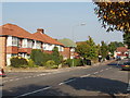

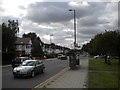
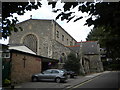
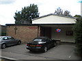


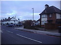
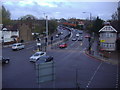
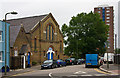
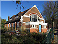
100 photos from this area
Area Information
Key information about the NW2 1UW including its size, population, and administrative classification.
- Area Type
- Postcode
- Area Size
- 3423 m²
- Population
- 2237
- Population Density
- 11208 people/km²
House Prices in NW2 1UW
42
Properties
£168,790
Average Sold Price
£91,000
Lowest Price
£291,000
Highest Price
Showing 42 properties
| Address | Type | Beds | Baths | Last Sale Price | Last Sale Date | |
|---|---|---|---|---|---|---|
| 118 Draycott Close, Cricklewood, London, NW2 1UW | Flat | - | - | £280,000 | Nov 2023 | |
| 97 Draycott Close, Cricklewood, London, NW2 1UW | Flat | 1 | 1 | £260,000 | May 2019 | |
| 112 Draycott Close, Cricklewood, London, NW2 1UW | Flat | - | - | £235,000 | Oct 2016 | |
| 120 Draycott Close, Cricklewood, London, NW2 1UW | Flat | - | - | £291,000 | Nov 2015 | |
| 93 Draycott Close, Cricklewood, London, NW2 1UW | Flat | - | - | £290,000 | Nov 2015 | |
| 109 Draycott Close, Cricklewood, London, NW2 1UW | Flat | 1 | 1 | £185,000 | Feb 2014 | |
| 87 Draycott Close, Cricklewood, London, NW2 1UW | Flat | - | - | £188,000 | Jan 2014 | |
| 108 Draycott Close, Cricklewood, London, NW2 1UW | Flat | - | - | £169,000 | Feb 2013 | |
| 91 Draycott Close, Cricklewood, London, NW2 1UW | Flat | - | - | £199,950 | Jan 2012 | |
| 90 Draycott Close, Cricklewood, London, NW2 1UW | Flat | 1 | 1 | £157,000 | Jul 2011 |
Page 1 of 5
Energy Efficiency in NW2 1UW
Amenities
Schools
| Rank | School | Type | Entry gender | Ages |
|---|
Explore more schools in this area
Go to Schools tabDemographics
Household Size
Family (3-5 people)
most common
Accommodation Type
Flats
most common
Tenure
37
majority
Ethnic Group
White
most common
Religion
N/A
most common
Household Composition
N/A
most common
Age
47
median
Adults (30-64 years)
most common
Household Deprivation
N/A
with no deprivation
NS-SEC
34
in Lower managerial occupations
Explore more demographic insights in this area
Go to Demographics tabPlanning
Planning Constraints
- Flood RiskPremium
- Ramsar Wetland SitesPremium
- Area of Outstanding Natural BeautyPremium
- Protected Nature ReservePremium
- Protected WoodlandPremium