Area Overview for NW11 8NE
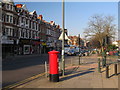
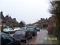
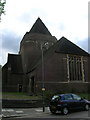
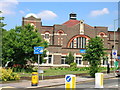
Photos of NW11 8NE


Area Information
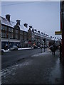
Living in NW11 8NE means residing within a dense, small residential cluster defined by a postcode covering just 9,533 square metres. This tiny area accommodates a population of 1,872 people, resulting in one of the highest population densities in London at 196,367 people per square kilometre. You are part of a compact community where every street corner is within easy reach of neighbours and local services. The environment is distinctly urban, focused on convenience rather than expansive space. Most people seeking homes here expect a flat arrangement due to the accommodation characteristics of this specific demographic. You will find yourself in a neighbourhood where daily life revolves around proximity to major transport hubs and retail chains. The area serves as a microcosm of north-west London living, bridging the gap between wide-open parks and busy thoroughfares. While the physical footprint is small, the cultural footprint connects you to the wider Golders Green and Highgate districts. You gain immediate access to five nearby railway stations, five metro stops, and several supermarkets without needing to travel far. This density ensures that your routine involves minimal commuting time across the immediate local ward. The cluster acts as a functional residential unit rather than a sprawling district, prioritising efficient living arrangements for adults who value location over suburban sprawl.
- Area Type
- Postcode
- Area Size
- 9533 m²
- Population
- 1872
- Population Density
- 9061 people/km²
You are entering a property market defined by high density and specific accommodation constraints within NW11 8NE. The housing stock is almost exclusively composed of flats, a direct consequence of the area's 9,533 square metre size and its capacity to house 1,872 people in a compact footprint. This means your options will centre on multi-storey buildings and modern complexes rather than traditional detached homes or semi-detached properties common in wider suburbs. The average population density of 196,367 people per square kilometre indicates a saturation of residential units designed for efficient use of limited space. Only 31 per cent of residents own their homes, suggesting that the majority of properties in this specific postcode function as long-term rentals or short-term lets. If you are looking to buy, you must navigate a market where private ownership is less common than in other parts of London. This dynamic often drives competition for available units, as the supply of flats is finite and located in a small cluster. You will find that buyers are likely targeting individuals or couples rather than large families requiring expansive grounds, given the flat-centric nature of the stock. The area offers a distinct opportunity for those who prioritise an urban setting with minimal walking distances to transport and amenities.
House Prices in NW11 8NE
Showing 22 properties
| Address | Type | Beds | Baths | Last Sale Price | Last Sale Date | |
|---|---|---|---|---|---|---|
| 25 Helenslea Avenue, Golders Green, London, NW11 8NE | Semi-detached | 6 | 3 | £1,900,000 | Oct 2024 | |
| 23 Helenslea Avenue, Golders Green, London, NW11 8NE | Semi-detached | 6 | - | £1,750,000 | Sep 2014 | |
| 5 Helenslea Avenue, Golders Green, London, NW11 8NE | house | 5 | - | £1,375,000 | Oct 2012 | |
| 7 Helenslea Avenue, Golders Green, London, NW11 8NE | house | 5 | 3 | £1,300,000 | May 2010 | |
| 27 Helenslea Avenue, Golders Green, London, NW11 8NE | Semi-detached | 5 | 4 | £485,000 | Dec 2000 | |
| 3 Helenslea Avenue, Golders Green, London, NW11 8NE | Semi-detached | - | - | £525,000 | Nov 1999 | |
| 15 Helenslea Avenue, Golders Green, London, NW11 8NE | Flat | 3 | 2 | - | - | |
| Flat 1, 1 Helenslea Avenue, Golders Green, London, NW11 8NE | Flat | 3 | 2 | - | - | |
| Flat 3, 1 Helenslea Avenue, Golders Green, London, NW11 8NE | Maisonette | 3 | 2 | - | - | |
| First Floor Flat, 15 Helenslea Avenue, Golders Green, London, NW11 8NE | Flat | - | - | - | - |
Energy Efficiency in NW11 8NE
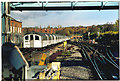
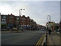
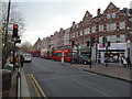
Your daily life in NW11 8NE is framed by immediate access to major retail and transport chains. You are surrounded by five retail outlets, with notable options including Sainsburys Golders, Sainsburys Golders Green, and Tesco Golders. These supermarkets are within practical reach, ensuring you can stock your kitchen with essentials without a significant journey. For public transport, you are situated near five metro stations and five rail terminals. Specific venues like Hampstead Station and Finchley Road and Frognal Station offer direct links to wider London networks. Entertainment and leisure options extend to river-based activities, with five waterbus stops available nearby. The London Zoo Waterbus Stop, Camden Lock Waterbus, and Little Venice Waterbus Stop provide unique recreational routes for residents seeking weekend breaks from the street. While bus services are less prominent with only three main stops listed near your postcode, they connect to major hubs like London Victoria Coach Station and the Green Line Coach Station. This mix of local supermarkets, major metro lines, and waterways creates a diverse lifestyle portfolio. You can manage grocery shopping, daily commutes, and leisurely boat trips all within a short travel radius from your doorstep.
Amenities
Schools
| Rank | School | Type | Entry gender | Ages |
|---|
Explore more schools in this area
Go to Schools tabDemographics
The community in NW11 8NE is predominantly comprised of adults aged between 30 and 64 years old. This age range forms the most common demographic group within the postcode area, indicating a settlement built for established families and professional workers rather than students or the young-at-heart. The median age across the population stands at 47 years old, reinforcing the mature character of the residents. You are likely to encounter a quiet, stable neighbourhood where long-term occupants have settled down and focused on their careers or raising children. Home ownership rates sit at 31 per cent, which suggests that a minority of residents own their homes outright or with a mortgage compared to the broader rental sector. This statistic shapes the tenancy landscape, meaning you will encounter a significant number of renters alongside the smaller group of freeholders. The predominant ethnic group is White, reflecting the broader historical settlement patterns of this part of London. The majority of addressable dwelling types are flats, a direct result of the high population density and the limited ground area of 9,533 square metres. This housing stock caters specifically to those requiring vertical living solutions in a tight urban footprint rather than detached houses or large terraced properties.
Household Size
Accommodation Type
Tenure
Ethnic Group
Religion
Household Composition
Age
Household Deprivation
NS-SEC
Explore more demographic insights in this area
Go to Demographics tabPlanning
Planning Constraints
- Flood RiskPremium
- Ramsar Wetland SitesPremium
- Area of Outstanding Natural BeautyPremium
- Protected Nature ReservePremium
- Protected WoodlandPremium