Area Overview for NW11 8NR
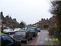
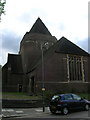
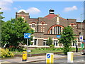
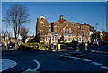
Photos of NW11 8NR


Area Information
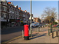
Living in NW11 8NR means residing within a specific postcode area that covers a small residential cluster in England. The population here amounts to 1872 residents, creating a neighbourhood that feels intimate yet connected to the wider Golders Green corridor. You will find yourself in a setting that prioritises convenience without enduring the congestion of larger commercial hubs. This specific location serves as a quiet residential enclave where daily life revolves around nearby tube stations and local shops. The area functions as a practical choice for those seeking a foothold in London's north-west without the sprawling nature of distant suburbs. Your morning routine likely involves a short walk or quick bus ride to access majoremployment centres, given the proximity of Golders Green Station and Brent Cross Station. The density of the housing, described as a cluster, suggests a community where neighbours know each other, though the small population figure indicates limited social infrastructure within the immediate postcode boundary. You are choosing a location defined by its precision rather than its grandeur. The 1872 residents share a postcode that bundles several individual properties into a single administrative unit. This makes NW11 8NR a microcosm of the broader Golders Green district, offering a taste of urban living with a markedly smaller footprint. It is a place where your focus shifts quickly from home work to local amenities, bridging the gap between private residence and public transport nodes.
- Area Type
- Postcode
- Area Size
- Not available
- Population
- 1872
- Population Density
- 9061 people/km²
You are entering a market defined by its accommodation type and tenure structure. Flats are the predominant housing stock in NW11 8NR, shaping the visual and functional character of the streets. This preference for flats aligns with the 31% home ownership rate, which implies that rental demand significantly outstrips the availability of owner-occupied stock. For a prospective buyer, this means competition is intense, and leases are often shorter or more flexible than traditional freehold properties in suburban zones. The small population of 1872 residents creates a tight-knit housing cluster where property movement can be fast and responsive. You will find that the majority of homes are leased, reflecting a lifestyle suited to tenants who move with career shifts. The high concentration of flats suggests that the area is part of a larger planning scheme designed for density rather than low-density sprawl. This is not a neighbourhood of detached villas or large family houses, but a collection of urban dwellings. Your search for homes in NW11 8NR should focus on efficiency and location rather than garden space or architectural grandeur. The fact that 69% of residents are renters indicates a high turnover rate for properties, making it a fluid market. If you aim to buy, you must navigate a sea of rentals where flats dominate the skyline. This context means you are better off considering homes in the immediate surroundings of NW11 8NR where ownership rates might differ or where larger family homes exist beyond the specific postcode cluster.
House Prices in NW11 8NR
No properties found in this postcode.
Energy Efficiency in NW11 8NR
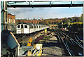
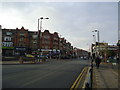
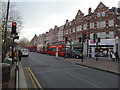
Living in NW11 8NR places you steps away from a network of retail and leisure facilities that define north-west London life. You have access to five notable retail options, including Sainsburys Golders Green, Sainsburys Golders, and Tesco Golders. These supermarkets handle your weekly grocery runs, reducing the need for lengthy trips into the city centre. Transport amenities further enhance your daily routine. Five metro stations and five rail stations form a transport web that connects you to the rest of London. Golders Green Station acts as your primary transport anchor, while Finchley Road & Frognal Station offers an alternative route for your travel plans. Diversity extends to leisure, with five ferry stops including London Zoo Waterbus and Camden Lock Waterbus Stop, allowing you to explore waterways without leaving the region. Bus services link you to major hubs like Liverpool Street and London Victoria Coach Station, although these are key drops rather than local stops. You can also reach the Green Line Coach Station from this vicinity. The concentration of amenities ensures you can book a dinner, buy fresh bread, or catch a train without significant planning. This density of services makes NW11 8NR a practical base for residents of varying needs, from those who shop weekly to those who travel daily for work.
Amenities
Schools
| Rank | School | Type | Entry gender | Ages |
|---|
Explore more schools in this area
Go to Schools tabDemographics
The community profile in NW11 8NR reflects a mature population with a median age of 47 years. Most commonly, residents fall into the adult bracket between 30 and 64 years old, suggesting a neighbourhood populated by working families, professionals, or empty nesters. You are unlikely to encounter the chaotic energy of a student quarter or a retirement village, as the age distribution points toward stability and established household routines. Home ownership stands at 31%, meaning the majority of residents are tenants rather than owners. This statistic indicates a rental-heavy market where you will likely be signing a lease rather than buying freehold property immediately. Flats form the predominant accommodation type, aligning with the high renter population and the urbanised nature of the Golders Green zone. This housing style suits professionals who value low-maintenance living over spacious gardens. The predominant ethnic group is White, which contributes to a demographic landscape typical of many inner-London areas with long-standing residential roots. There are no complex deprivation metrics provided for this specific cluster, but the age and tenure figures paint a clear picture. You are dealing with an area where young adults and middle-aged professionals rent flats in clusters. The 31% ownership rate signals a dynamic market where students or incoming professionals frequently cycle through the area while long-term tenants settle into the 47-year-old demographic median.
Household Size
Accommodation Type
Tenure
Ethnic Group
Religion
Household Composition
Age
Household Deprivation
NS-SEC
Explore more demographic insights in this area
Go to Demographics tabPlanning
Planning Constraints
- Flood RiskPremium
- Ramsar Wetland SitesPremium
- Area of Outstanding Natural BeautyPremium
- Protected Nature ReservePremium
- Protected WoodlandPremium