Area Overview for N9 9AL
Photos of N9 9AL
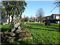
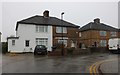
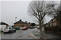
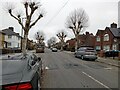
16 photos from this area
Area Information
Key information about the N9 9AL including its size, population, and administrative classification.
- Area Type
- Postcode
- Area Size
- 5793 m²
- Population
- 1576
- Population Density
- 5448 people/km²
House Prices in N9 9AL
30
Properties
£226,993
Average Sold Price
£54,000
Lowest Price
£315,000
Highest Price
Showing 30 properties
| Address | Type | Beds | Baths | Last Sale Price | Last Sale Date | |
|---|---|---|---|---|---|---|
| 321 Haselbury Road, Edmonton, N9 9AL | Flat | 3 | 2 | £290,000 | Jul 2025 | |
| 347 Haselbury Road, Edmonton, N9 9AL | Flat | - | - | £269,950 | Nov 2022 | |
| 333 Haselbury Road, Edmonton, N9 9AL | Flat | - | - | £265,000 | Sep 2020 | |
| 319 Haselbury Road, Edmonton, N9 9AL | Flat | - | - | £315,000 | Oct 2018 | |
| 345 Haselbury Road, Edmonton, N9 9AL | Flat | - | - | £270,000 | May 2018 | |
| 337 Haselbury Road, Edmonton, N9 9AL | Flat | - | - | £125,000 | Aug 2014 | |
| 349 Haselbury Road, Edmonton, N9 9AL | Flat | - | - | £54,000 | Jan 1999 | |
| 325-331 Haselbury Road, Edmonton, N9 9AL | Flat | - | - | - | - | |
| 309 Haselbury Road, Edmonton, N9 9AL | Flat | - | - | - | - | |
| 317 Haselbury Road, Edmonton, N9 9AL | Flat | - | - | - | - |
Page 1 of 3
Energy Efficiency in N9 9AL
Amenities
Schools
| Rank | School | Type | Entry gender | Ages |
|---|
Explore more schools in this area
Go to Schools tabDemographics
Household Size
One person
most common
Accommodation Type
Flats
most common
Tenure
30
majority
Ethnic Group
White
most common
Religion
N/A
most common
Household Composition
N/A
most common
Age
47
median
Adults (30-64 years)
most common
Household Deprivation
N/A
with no deprivation
NS-SEC
15
in Lower managerial occupations
Explore more demographic insights in this area
Go to Demographics tabPlanning
Planning Constraints
- Flood RiskPremium
- Ramsar Wetland SitesPremium
- Area of Outstanding Natural BeautyPremium
- Protected Nature ReservePremium
- Protected WoodlandPremium