Area Overview for N9 7JP
Photos of N9 7JP
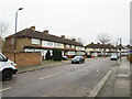
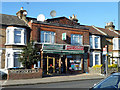
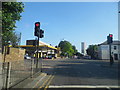
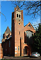
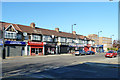
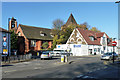
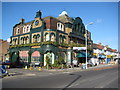
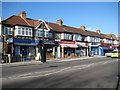
21 photos from this area
Area Information
Key information about the N9 7JP including its size, population, and administrative classification.
- Area Type
- Postcode
- Area Size
- 9767 m²
- Population
- 1979
- Population Density
- 15061 people/km²
House Prices in N9 7JP
50
Properties
£168,800
Average Sold Price
£47,500
Lowest Price
£372,000
Highest Price
Showing 50 properties
| Address | Type | Beds | Baths | Last Sale Price | Last Sale Date | |
|---|---|---|---|---|---|---|
| 157B Bury Street, Edmonton, N9 7JP | Flat | - | - | £266,000 | Dec 2025 | |
| 123 Bury Street, Edmonton, N9 7JP | Terraced | 2 | 1 | £372,000 | Nov 2025 | |
| 153 Bury Street, Edmonton, N9 7JP | Terraced | 3 | 1 | £362,500 | Feb 2025 | |
| 99 Bury Street, Edmonton, N9 7JP | house | - | - | £338,000 | Dec 2016 | |
| 133 Bury Street, Edmonton, N9 7JP | Flat | - | - | £200,000 | Mar 2016 | |
| 141 Bury Street, Edmonton, N9 7JP | Flat | 1 | 1 | £176,000 | Jul 2015 | |
| 127 Bury Street, Edmonton, N9 7JP | Maisonette | 2 | 2 | £151,000 | Apr 2014 | |
| 113 Bury Street, Edmonton, N9 7JP | house | 3 | 2 | £225,000 | Jun 2013 | |
| 143 Bury Street, Edmonton, N9 7JP | house | 2 | - | £217,500 | Sep 2010 | |
| 137 Bury Street, Edmonton, N9 7JP | house | - | - | £225,000 | Feb 2010 |
Page 1 of 5
Energy Efficiency in N9 7JP
Amenities
Schools
| Rank | School | Type | Entry gender | Ages |
|---|
Explore more schools in this area
Go to Schools tabDemographics
Household Size
Family (3-5 people)
most common
Accommodation Type
Houses
most common
Tenure
46
majority
Ethnic Group
White
most common
Religion
N/A
most common
Household Composition
N/A
most common
Age
47
median
Adults (30-64 years)
most common
Household Deprivation
N/A
with no deprivation
NS-SEC
20
in Lower managerial occupations
Explore more demographic insights in this area
Go to Demographics tabPlanning
Planning Constraints
- Flood RiskPremium
- Ramsar Wetland SitesPremium
- Area of Outstanding Natural BeautyPremium
- Protected Nature ReservePremium
- Protected WoodlandPremium