Area Overview for N9 0JR
Photos of N9 0JR
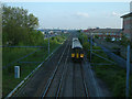
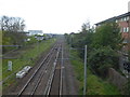
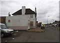
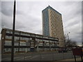
20 photos from this area
Area Information
Key information about the N9 0JR including its size, population, and administrative classification.
- Area Type
- Postcode
- Area Size
- 4027 m²
- Population
- 2038
- Population Density
- 13277 people/km²
House Prices in N9 0JR
29
Properties
£251,363
Average Sold Price
£51,500
Lowest Price
£400,125
Highest Price
Showing 29 properties
| Address | Type | Beds | Baths | Last Sale Price | Last Sale Date | |
|---|---|---|---|---|---|---|
| 51 Cornwallis Grove, Edmonton, N9 0JR | Terraced | 2 | 1 | £390,000 | Oct 2025 | |
| 49 Cornwallis Grove, Edmonton, N9 0JR | Terraced | 2 | 1 | £350,000 | Sep 2025 | |
| 35 Cornwallis Grove, Edmonton, N9 0JR | Terraced | 2 | 1 | £395,000 | Jun 2023 | |
| 3 Cornwallis Grove, Edmonton, N9 0JR | Terraced | 2 | 1 | £380,000 | May 2023 | |
| 53 Cornwallis Grove, Edmonton, N9 0JR | Terraced | 3 | 1 | £400,125 | May 2022 | |
| 19 Cornwallis Grove, Edmonton, N9 0JR | Terraced | 2 | 1 | £335,000 | Mar 2019 | |
| 31 Cornwallis Grove, Edmonton, N9 0JR | Terraced | 3 | 1 | £390,000 | May 2018 | |
| 45 Cornwallis Grove, Edmonton, N9 0JR | Terraced | 3 | 1 | £351,000 | Oct 2017 | |
| 17 Cornwallis Grove, Edmonton, N9 0JR | Terraced | 3 | 1 | £300,000 | Mar 2016 | |
| 55 Cornwallis Grove, Edmonton, N9 0JR | Terraced | 2 | 1 | £287,500 | May 2015 |
Page 1 of 3
Energy Efficiency in N9 0JR
Amenities
Schools
| Rank | School | Type | Entry gender | Ages |
|---|
Explore more schools in this area
Go to Schools tabDemographics
Household Size
Family (3-5 people)
most common
Accommodation Type
Houses
most common
Tenure
48
majority
Ethnic Group
White
most common
Religion
N/A
most common
Household Composition
N/A
most common
Age
47
median
Adults (30-64 years)
most common
Household Deprivation
N/A
with no deprivation
NS-SEC
21
in Lower managerial occupations
Explore more demographic insights in this area
Go to Demographics tabPlanning
Planning Constraints
- Flood RiskPremium
- Ramsar Wetland SitesPremium
- Area of Outstanding Natural BeautyPremium
- Protected Nature ReservePremium
- Protected WoodlandPremium