Area Overview for N20 8HD
Photos of N20 8HD
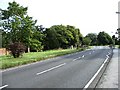
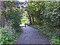
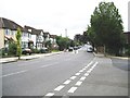
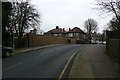
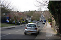
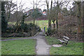
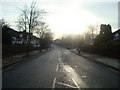

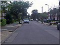

64 photos from this area
Area Information
Key information about the N20 8HD including its size, population, and administrative classification.
- Area Type
- Postcode
- Area Size
- 2.2 hectares
- Population
- 1337
- Population Density
- 1316 people/km²
House Prices in N20 8HD
24
Properties
£775,321
Average Sold Price
£185,000
Lowest Price
£1,686,000
Highest Price
Showing 24 properties
| Address | Type | Beds | Baths | Last Sale Price | Last Sale Date | |
|---|---|---|---|---|---|---|
| Site Of 4, Hill Crescent, Whetstone, London, N20 8HD | Detached | 5 | 5 | £1,425,000 | Mar 2022 | |
| 8 Hill Crescent, Whetstone, London, N20 8HD | house | 5 | 2 | £1,370,000 | Jun 2017 | |
| 10 Hill Crescent, Whetstone, London, N20 8HD | Detached | 4 | 2 | £1,150,000 | Jul 2016 | |
| 20 Hill Crescent, Whetstone, London, N20 8HD | Detached | 7 | - | £1,686,000 | Apr 2013 | |
| 28 Hill Crescent, Whetstone, London, N20 8HD | house | - | - | £735,000 | Apr 2013 | |
| Arba-bet, 4B Hill Crescent, Whetstone, London, N20 8HD | house | - | - | £1,090,000 | Aug 2010 | |
| 12 Hill Crescent, Whetstone, London, N20 8HD | Detached | 5 | 2 | £645,000 | Nov 2009 | |
| 26 Hill Crescent, Whetstone, London, N20 8HD | house | 4 | - | £680,000 | Aug 2009 | |
| 22 Hill Crescent, Whetstone, London, N20 8HD | Semi-detached | 5 | 3 | £451,000 | Sep 2002 | |
| 40 Hill Crescent, Whetstone, London, N20 8HD | Detached | 3 | 2 | £265,000 | Jul 1998 |
Page 1 of 3
Energy Efficiency in N20 8HD
Amenities
Schools
| Rank | School | Type | Entry gender | Ages |
|---|
Explore more schools in this area
Go to Schools tabDemographics
Household Size
Family (3-5 people)
most common
Accommodation Type
Houses
most common
Tenure
87
majority
Ethnic Group
White
most common
Religion
N/A
most common
Household Composition
N/A
most common
Age
47
median
Adults (30-64 years)
most common
Household Deprivation
N/A
with no deprivation
NS-SEC
55
in Lower managerial occupations
Explore more demographic insights in this area
Go to Demographics tabPlanning
Planning Constraints
- Flood RiskPremium
- Ramsar Wetland SitesPremium
- Area of Outstanding Natural BeautyPremium
- Protected Nature ReservePremium
- Protected WoodlandPremium