Area Overview for N17 0JA
Photos of N17 0JA
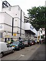
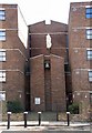
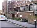
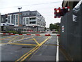
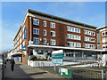
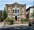
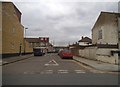

53 photos from this area
Area Information
Key information about the N17 0JA including its size, population, and administrative classification.
- Area Type
- Postcode
- Area Size
- 6296 m²
- Population
- 2267
- Population Density
- 15301 people/km²
House Prices in N17 0JA
25
Properties
£241,833
Average Sold Price
£86,000
Lowest Price
£390,000
Highest Price
Showing 25 properties
| Address | Type | Beds | Baths | Last Sale Price | Last Sale Date | |
|---|---|---|---|---|---|---|
| 210 Park Lane, Tottenham, London, N17 0JA | Terraced | 3 | 1 | £390,000 | Oct 2014 | |
| 206 Park Lane, Tottenham, London, N17 0JA | Terraced | 3 | 2 | £250,000 | Oct 2013 | |
| 198 Park Lane, Tottenham, London, N17 0JA | house | - | - | £235,000 | Aug 2009 | |
| 200 Park Lane, Tottenham, London, N17 0JA | Terraced | - | - | £285,000 | Nov 2008 | |
| 186 Park Lane, Tottenham, London, N17 0JA | Terraced | 3 | 1 | £205,000 | Aug 2005 | |
| 204 Park Lane, Tottenham, London, N17 0JA | Terraced | - | - | £86,000 | Dec 1998 | |
| 190 Park Lane, Tottenham, London, N17 0JA | Terraced | 3 | 2 | - | - | |
| 188 Park Lane, Tottenham, London, N17 0JA | Terraced | 3 | 1 | - | - | |
| 202 Park Lane, Tottenham, London, N17 0JA | house | 3 | - | - | - | |
| Flat 2, 196 Park Lane, Tottenham, London, N17 0JA | Flat | - | - | - | - |
Page 1 of 3
Energy Efficiency in N17 0JA
Amenities
Schools
| Rank | School | Type | Entry gender | Ages |
|---|
Explore more schools in this area
Go to Schools tabDemographics
Household Size
One person
most common
Accommodation Type
Houses
most common
Tenure
28
majority
Ethnic Group
White
most common
Religion
N/A
most common
Household Composition
N/A
most common
Age
47
median
Adults (30-64 years)
most common
Household Deprivation
N/A
with no deprivation
NS-SEC
19
in Lower managerial occupations
Explore more demographic insights in this area
Go to Demographics tabPlanning
Planning Constraints
- Flood RiskPremium
- Ramsar Wetland SitesPremium
- Area of Outstanding Natural BeautyPremium
- Protected Nature ReservePremium
- Protected WoodlandPremium