Area Overview for N16 0AJ
Photos of N16 0AJ
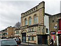
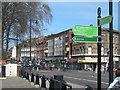
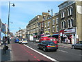
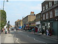

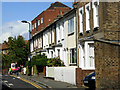
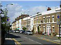
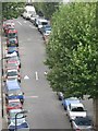
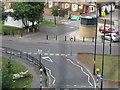
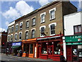
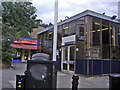

100 photos from this area
Area Information
Key information about the N16 0AJ including its size, population, and administrative classification.
- Area Type
- Postcode
- Area Size
- 3.3 hectares
- Population
- 1227
- Population Density
- 8324 people/km²
House Prices in N16 0AJ
64
Properties
£857,358
Average Sold Price
£290,000
Lowest Price
£1,550,000
Highest Price
Showing 64 properties
| Address | Type | Beds | Baths | Last Sale Price | Last Sale Date | |
|---|---|---|---|---|---|---|
| 52 Bouverie Road, Hackney, London, N16 0AJ | Semi-detached | 3 | 1 | £1,550,000 | Feb 2025 | |
| Flat A, 34 Bouverie Road, Hackney, London, N16 0AJ | Flat | 1 | 1 | £506,225 | Dec 2024 | |
| 8 Abney Mews, Hackney, London, N16 0AJ | Terraced | 3 | - | £1,175,000 | Oct 2022 | |
| 6 Bouverie Road, Hackney, London, N16 0AJ | Retail | 3 | 1 | £1,167,500 | Apr 2022 | |
| 4 Bouverie Road, Hackney, London, N16 0AJ | Terraced | 5 | 2 | £1,000,000 | Feb 2019 | |
| 9 Abney Mews, Hackney, London, N16 0AJ | Terraced | 3 | 2 | £1,100,000 | Jun 2017 | |
| 22 Bouverie Road, Hackney, London, N16 0AJ | house | - | - | £450,000 | Aug 2004 | |
| 16 Bouverie Road, Hackney, London, N16 0AJ | Terraced | - | - | £477,500 | May 2004 | |
| 20 Bouverie Road, Hackney, London, N16 0AJ | house | - | - | £290,000 | Jun 2002 | |
| Flat 5, Parkview Apartments, Abney Mews, Hackney, London, N16 0AJ | Flat | 2 | 2 | - | - |
Page 1 of 7
Energy Efficiency in N16 0AJ
Amenities
Schools
| Rank | School | Type | Entry gender | Ages |
|---|
Explore more schools in this area
Go to Schools tabDemographics
Household Size
Two person
most common
Accommodation Type
Flats
most common
Tenure
33
majority
Ethnic Group
White
most common
Religion
N/A
most common
Household Composition
N/A
most common
Age
47
median
Adults (30-64 years)
most common
Household Deprivation
N/A
with no deprivation
NS-SEC
47
in Lower managerial occupations
Explore more demographic insights in this area
Go to Demographics tabPlanning
Planning Constraints
- Flood RiskPremium
- Ramsar Wetland SitesPremium
- Area of Outstanding Natural BeautyPremium
- Protected Nature ReservePremium
- Protected WoodlandPremium