Area Overview for N15 6UN
Photos of N15 6UN
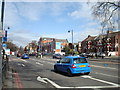
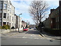
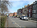
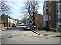
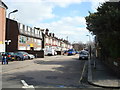
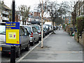
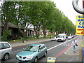
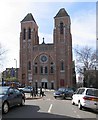
100 photos from this area
Area Information
Key information about the N15 6UN including its size, population, and administrative classification.
- Area Type
- Postcode
- Area Size
- 2402 m²
- Population
- 1990
- Population Density
- 18274 people/km²
House Prices in N15 6UN
14
Properties
£352,542
Average Sold Price
£59,750
Lowest Price
£1,000,000
Highest Price
Showing 14 properties
| Address | Type | Beds | Baths | Last Sale Price | Last Sale Date | |
|---|---|---|---|---|---|---|
| Birch View House, 61 Elm Park Avenue, Tottenham, London, N15 6UN | Terraced | - | - | £1,000,000 | Mar 2018 | |
| 59 Elm Park Avenue, Tottenham, London, N15 6UN | Semi-detached | - | - | £432,500 | Jan 2007 | |
| 69 Elm Park Avenue, Tottenham, London, N15 6UN | house | - | - | £280,000 | Mar 2005 | |
| 71 Elm Park Avenue, Tottenham, London, N15 6UN | house | - | - | £250,000 | Jun 2004 | |
| 63 Elm Park Avenue, Tottenham, London, N15 6UN | house | - | - | £93,000 | Oct 1998 | |
| 75 Elm Park Avenue, Tottenham, London, N15 6UN | Terraced | - | - | £59,750 | Oct 1995 | |
| 59A Elm Park Avenue, Tottenham, London, N15 6UN | Detached | - | - | - | - | |
| 59B Elm Park Avenue, Tottenham, London, N15 6UN | undefined | - | - | - | - | |
| 63A Elm Park Avenue, Tottenham, London, N15 6UN | house | - | - | - | - | |
| First Floor Flat A, 67 Elm Park Avenue, Tottenham, London, N15 6UN | Flat | - | - | - | - |
Page 1 of 2
Energy Efficiency in N15 6UN
Amenities
Schools
| Rank | School | Type | Entry gender | Ages |
|---|
Explore more schools in this area
Go to Schools tabDemographics
Household Size
Family (3-5 people)
most common
Accommodation Type
Houses
most common
Tenure
41
majority
Ethnic Group
White
most common
Religion
N/A
most common
Household Composition
N/A
most common
Age
22
median
Children (0-14 years)
most common
Household Deprivation
N/A
with no deprivation
NS-SEC
26
in Lower managerial occupations
Explore more demographic insights in this area
Go to Demographics tabPlanning
Planning Constraints
- Flood RiskPremium
- Ramsar Wetland SitesPremium
- Area of Outstanding Natural BeautyPremium
- Protected Nature ReservePremium
- Protected WoodlandPremium