Area Overview for N14 6HX
Photos of N14 6HX


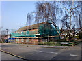
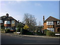
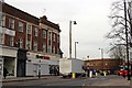
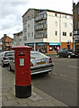
100 photos from this area
Area Information
Key information about the N14 6HX including its size, population, and administrative classification.
- Area Type
- Postcode
- Area Size
- 7124 m²
- Population
- 1857
- Population Density
- 5267 people/km²
House Prices in N14 6HX
21
Properties
£207,393
Average Sold Price
£110,000
Lowest Price
£285,000
Highest Price
Showing 21 properties
| Address | Type | Beds | Baths | Last Sale Price | Last Sale Date | |
|---|---|---|---|---|---|---|
| 267 Chase Road, Southgate, N14 6HX | Terraced | 2 | 1 | £268,250 | Feb 2012 | |
| 255 Chase Road, Southgate, N14 6HX | Terraced | 3 | - | £285,000 | Apr 2008 | |
| 261 Chase Road, Southgate, N14 6HX | Terraced | 2 | - | £263,000 | May 2007 | |
| 257 Chase Road, Southgate, N14 6HX | Terraced | - | - | £230,000 | Apr 2004 | |
| 281 Chase Road, Southgate, N14 6HX | house | - | - | £178,000 | Aug 2001 | |
| 283 Chase Road, Southgate, N14 6HX | Terraced | - | - | £110,000 | Aug 1999 | |
| 263 Chase Road, Southgate, N14 6HX | house | - | - | £117,500 | May 1999 | |
| 277 Chase Road, Southgate, N14 6HX | Terraced | - | - | - | - | |
| 259 Chase Road, Southgate, N14 6HX | house | - | - | - | - | |
| 253 Chase Road, Southgate, N14 6HX | house | - | - | - | - |
Page 1 of 3
Energy Efficiency in N14 6HX
Amenities
Schools
| Rank | School | Type | Entry gender | Ages |
|---|
Explore more schools in this area
Go to Schools tabDemographics
Household Size
Family (3-5 people)
most common
Accommodation Type
Houses
most common
Tenure
58
majority
Ethnic Group
White
most common
Religion
N/A
most common
Household Composition
N/A
most common
Age
47
median
Adults (30-64 years)
most common
Household Deprivation
N/A
with no deprivation
NS-SEC
37
in Lower managerial occupations
Explore more demographic insights in this area
Go to Demographics tabPlanning
Planning Constraints
- Flood RiskPremium
- Ramsar Wetland SitesPremium
- Area of Outstanding Natural BeautyPremium
- Protected Nature ReservePremium
- Protected WoodlandPremium