Area Overview for N14 4LN
Photos of N14 4LN
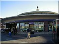

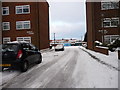

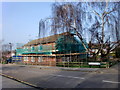
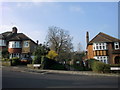
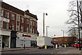
100 photos from this area
Area Information
Key information about the N14 4LN including its size, population, and administrative classification.
- Area Type
- Postcode
- Area Size
- 2.1 hectares
- Population
- 1857
- Population Density
- 5267 people/km²
House Prices in N14 4LN
37
Properties
£231,033
Average Sold Price
£99,000
Lowest Price
£599,950
Highest Price
Showing 37 properties
| Address | Type | Beds | Baths | Last Sale Price | Last Sale Date | |
|---|---|---|---|---|---|---|
| 33 Ivy Road, Southgate, N14 4LN | Semi-detached | 2 | 1 | £500,000 | Jun 2023 | |
| 14 Ivy Road, Southgate, N14 4LN | Flat | - | - | £325,500 | Sep 2018 | |
| 36 Ivy Road, Southgate, N14 4LN | Detached | 3 | 2 | £599,950 | Jun 2017 | |
| 11 Ivy Road, Southgate, N14 4LN | Flat | 3 | 1 | £312,000 | Jun 2015 | |
| 26 Ivy Road, Southgate, N14 4LN | Flat | 2 | 1 | £250,000 | Oct 2014 | |
| 18 Ivy Road, Southgate, N14 4LN | Flat | - | - | £250,000 | Sep 2014 | |
| 27 Ivy Road, Southgate, N14 4LN | Flat | - | - | £220,000 | Mar 2012 | |
| 15 Ivy Road, Southgate, N14 4LN | Flat | - | - | £176,000 | Nov 2011 | |
| 23 Ivy Road, Southgate, N14 4LN | Flat | - | - | £240,000 | Oct 2011 | |
| 21 Ivy Road, Southgate, N14 4LN | Flat | - | - | £172,000 | Aug 2010 |
Page 1 of 4
Energy Efficiency in N14 4LN
Amenities
Schools
| Rank | School | Type | Entry gender | Ages |
|---|
Explore more schools in this area
Go to Schools tabDemographics
Household Size
Family (3-5 people)
most common
Accommodation Type
Houses
most common
Tenure
58
majority
Ethnic Group
White
most common
Religion
N/A
most common
Household Composition
N/A
most common
Age
47
median
Adults (30-64 years)
most common
Household Deprivation
N/A
with no deprivation
NS-SEC
37
in Lower managerial occupations
Explore more demographic insights in this area
Go to Demographics tabPlanning
Planning Constraints
- Flood RiskPremium
- Ramsar Wetland SitesPremium
- Area of Outstanding Natural BeautyPremium
- Protected Nature ReservePremium
- Protected WoodlandPremium