Area Overview for N14 4LD
Photos of N14 4LD
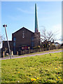
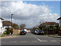
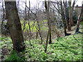
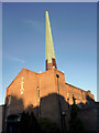
100 photos from this area
Area Information
Key information about the N14 4LD including its size, population, and administrative classification.
- Area Type
- Postcode
- Area Size
- 1.1 hectares
- Population
- 1562
- Population Density
- 6061 people/km²
House Prices in N14 4LD
16
Properties
£508,750
Average Sold Price
£310,000
Lowest Price
£725,000
Highest Price
Showing 16 properties
| Address | Type | Beds | Baths | Last Sale Price | Last Sale Date | |
|---|---|---|---|---|---|---|
| 106 Chase Road, Southgate, N14 4LD | Semi-detached | 3 | 2 | £315,000 | Jan 2018 | |
| 104 Chase Road, Southgate, N14 4LD | house | - | - | £610,000 | Nov 2015 | |
| 116 Chase Road, Southgate, N14 4LD | house | - | - | £510,000 | Dec 2013 | |
| 102 Chase Road, Southgate, N14 4LD | house | - | - | £460,000 | Oct 2013 | |
| 96 Chase Road, Southgate, N14 4LD | Detached | 4 | 2 | £725,000 | Nov 2010 | |
| 98 Chase Road, Southgate, N14 4LD | house | - | - | £655,000 | Oct 2007 | |
| 94 Chase Road, Southgate, N14 4LD | Terraced | - | - | £485,000 | Sep 2007 | |
| 90 Chase Road, Southgate, N14 4LD | Detached | 4 | - | £310,000 | Feb 2000 | |
| 114 Chase Road, Southgate, N14 4LD | Semi-detached | - | - | - | - | |
| 120 Chase Road, Southgate, N14 4LD | Semi-detached | - | - | - | - |
Page 1 of 2
Energy Efficiency in N14 4LD
Amenities
Schools
| Rank | School | Type | Entry gender | Ages |
|---|
Explore more schools in this area
Go to Schools tabDemographics
Household Size
Family (3-5 people)
most common
Accommodation Type
Houses
most common
Tenure
58
majority
Ethnic Group
White
most common
Religion
N/A
most common
Household Composition
N/A
most common
Age
47
median
Adults (30-64 years)
most common
Household Deprivation
N/A
with no deprivation
NS-SEC
38
in Lower managerial occupations
Explore more demographic insights in this area
Go to Demographics tabPlanning
Planning Constraints
- Flood RiskPremium
- Ramsar Wetland SitesPremium
- Area of Outstanding Natural BeautyPremium
- Protected Nature ReservePremium
- Protected WoodlandPremium