Area Overview for N14 4AT
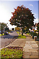
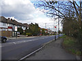
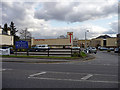
Photos of N14 4AT


Area Information
N14 4AT is a compact residential postcode in England, spanning 2,163 square metres and home to 1,783 residents. Its high population density—824,468 people per square kilometre—reflects a tightly knit community. The area is characterised by a mature demographic, with a median age of 47 and a majority of residents aged 30–64. This suggests a stable, established population, likely centred around family homes. The area’s small size means it is highly walkable, with amenities and services within close proximity. While it lacks large-scale infrastructure, its proximity to transport hubs and retail centres makes it practical for daily life. The mix of housing stock, primarily owner-occupied homes, indicates a long-term presence of residents. N14 4AT’s appeal lies in its balance of privacy, convenience, and accessibility, though its density may feel limiting for those seeking expansive living spaces.
- Area Type
- Postcode
- Area Size
- 2163 m²
- Population
- 1783
- Population Density
- 5011 people/km²
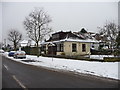
The property market in N14 4AT is dominated by owner-occupied homes, with 51% of properties being owned by residents. The accommodation type is primarily houses, which is unusual for a small postcode area, suggesting a mix of older, established properties. This indicates a market skewed towards long-term residents rather than a rental-heavy area. The high home ownership rate implies a stable demand for housing, though the limited area size may mean competition for available properties. Buyers should consider the immediate surrounding areas for more options, as the small footprint of N14 4AT itself may restrict availability. The focus on houses rather than flats suggests a preference for private, family-oriented living spaces, which could appeal to those seeking traditional housing.
House Prices in N14 4AT
No properties found in this postcode.
Energy Efficiency in N14 4AT
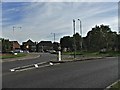
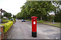
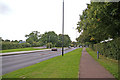
Daily life in N14 4AT is supported by a range of nearby amenities. Residents can access five metro stations, including Oakwood and Cockfosters, which link to broader transport networks. Retail options such as Tesco Southgate Bramley and Sainsburys Cockfosters Heddon offer grocery and general shopping. The presence of M&S Cockfosters BP adds to the convenience of everyday errands. While the data does not specify dining or leisure venues, the proximity to transport hubs suggests access to larger urban amenities. The compact nature of the area means that essential services are within walking distance, fostering a lifestyle that balances convenience with the need for occasional travel to nearby centres.
Amenities
Schools
The area is served by three primary schools: De Bohun Primary School, De Bohun Junior School, and De Bohun Infant School. These institutions provide a range of early education options for young children, covering both younger and older primary age groups. The presence of a Behaviour Support Service, though not a traditional school, indicates additional resources for students requiring special needs support. The concentration of primary schools suggests the area is well-suited for families with young children, though no secondary schools are listed in the data. The lack of higher education institutions or further schooling options may require families to look beyond the immediate vicinity for comprehensive educational needs.
| Rank | School | Type | Entry gender | Ages |
|---|
Explore more schools in this area
Go to Schools tabDemographics
The community in N14 4AT is predominantly composed of adults aged 30–64, with a median age of 47. This suggests a mature, settled population, likely with established careers and families. Home ownership is strong, at 51%, with the majority of properties being houses rather than flats. The predominant ethnic group is White, though no specific diversity metrics are provided. The age profile indicates a community with a focus on stability, potentially with fewer young families compared to other areas. The absence of detailed data on deprivation means that quality of life is inferred from the high home ownership rate and the presence of essential services. The compact nature of the area may foster a close-knit social environment, though it also limits the diversity of household types typically found in larger urban settings.
Household Size
Accommodation Type
Tenure
Ethnic Group
Religion
Household Composition
Age
Household Deprivation
NS-SEC
Explore more demographic insights in this area
Go to Demographics tabPlanning
Planning Constraints
- Flood RiskPremium
- Ramsar Wetland SitesPremium
- Area of Outstanding Natural BeautyPremium
- Protected Nature ReservePremium
- Protected WoodlandPremium