Area Overview for N13 5QH
Photos of N13 5QH
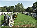
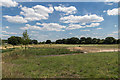

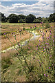
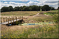

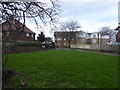
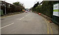
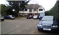
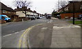
45 photos from this area
Area Information
Key information about the N13 5QH including its size, population, and administrative classification.
- Area Type
- Postcode
- Area Size
- 8551 m²
- Population
- 1477
- Population Density
- 9106 people/km²
House Prices in N13 5QH
29
Properties
£286,329
Average Sold Price
£101,000
Lowest Price
£585,000
Highest Price
Showing 29 properties
| Address | Type | Beds | Baths | Last Sale Price | Last Sale Date | |
|---|---|---|---|---|---|---|
| 279 Firs Lane, Southgate, N13 5QH | Terraced | 3 | 1 | £585,000 | Feb 2025 | |
| 265 Firs Lane, Southgate, N13 5QH | Terraced | 3 | 1 | £580,000 | Oct 2022 | |
| 301 Firs Lane, Southgate, N13 5QH | Terraced | 3 | 1 | £499,995 | Oct 2014 | |
| 299 Firs Lane, Southgate, N13 5QH | Flat | - | - | £250,000 | Nov 2012 | |
| 273 Firs Lane, Southgate, N13 5QH | house | 3 | - | £287,500 | Nov 2011 | |
| 283 Firs Lane, Southgate, N13 5QH | Terraced | - | - | £359,500 | Jun 2005 | |
| 261 Firs Lane, Southgate, N13 5QH | Terraced | - | - | £263,000 | Feb 2003 | |
| 285 Firs Lane, Southgate, N13 5QH | Terraced | - | - | £129,950 | Jan 1999 | |
| 275 Firs Lane, Southgate, N13 5QH | house | - | - | £122,000 | May 1998 | |
| 259 Firs Lane, Southgate, N13 5QH | Terraced | - | - | £128,000 | Dec 1997 |
Page 1 of 3
Energy Efficiency in N13 5QH
Amenities
Schools
| Rank | School | Type | Entry gender | Ages |
|---|
Explore more schools in this area
Go to Schools tabDemographics
Household Size
Family (3-5 people)
most common
Accommodation Type
Houses
most common
Tenure
80
majority
Ethnic Group
White
most common
Religion
N/A
most common
Household Composition
N/A
most common
Age
47
median
Adults (30-64 years)
most common
Household Deprivation
N/A
with no deprivation
NS-SEC
32
in Lower managerial occupations
Explore more demographic insights in this area
Go to Demographics tabPlanning
Planning Constraints
- Flood RiskPremium
- Ramsar Wetland SitesPremium
- Area of Outstanding Natural BeautyPremium
- Protected Nature ReservePremium
- Protected WoodlandPremium