Area Overview for N13 4HD
Photos of N13 4HD
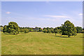
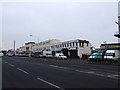
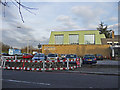
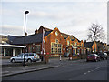

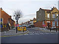
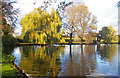
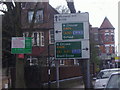
100 photos from this area
Area Information
Key information about the N13 4HD including its size, population, and administrative classification.
- Area Type
- Postcode
- Area Size
- 1.5 hectares
- Population
- 2054
- Population Density
- 5221 people/km²
House Prices in N13 4HD
58
Properties
£474,228
Average Sold Price
£90,000
Lowest Price
£1,045,000
Highest Price
Showing 58 properties
| Address | Type | Beds | Baths | Last Sale Price | Last Sale Date | |
|---|---|---|---|---|---|---|
| 15 Belmont Avenue, Southgate, N13 4HD | Flat | - | - | £530,000 | Mar 2025 | |
| 4 Belmont Avenue, Southgate, N13 4HD | Semi-detached | 5 | 2 | £1,045,000 | Jun 2024 | |
| 40 Belmont Avenue, Southgate, N13 4HD | Terraced | 3 | 1 | £640,000 | Jun 2024 | |
| 10 Belmont Avenue, Southgate, N13 4HD | Flat | 3 | 2 | £500,000 | Sep 2022 | |
| 12 Belmont Avenue, Southgate, N13 4HD | Retail | 5 | 3 | £901,000 | May 2022 | |
| 25 Belmont Avenue, Southgate, N13 4HD | Terraced | - | - | £160,000 | Oct 2021 | |
| 29 Belmont Avenue, Southgate, N13 4HD | Semi-detached | 5 | 3 | £840,000 | Jan 2021 | |
| 16 Belmont Avenue, Southgate, N13 4HD | Flat | 2 | 1 | £430,000 | Oct 2019 | |
| 22 Belmont Avenue, Southgate, N13 4HD | Flat | - | - | £390,000 | Jul 2018 | |
| 19 Belmont Avenue, Southgate, N13 4HD | Terraced | 3 | 1 | £800,000 | Apr 2018 |
Page 1 of 6
Energy Efficiency in N13 4HD
Amenities
Schools
| Rank | School | Type | Entry gender | Ages |
|---|
Explore more schools in this area
Go to Schools tabDemographics
Household Size
Family (3-5 people)
most common
Accommodation Type
Houses
most common
Tenure
61
majority
Ethnic Group
White
most common
Religion
N/A
most common
Household Composition
N/A
most common
Age
47
median
Adults (30-64 years)
most common
Household Deprivation
N/A
with no deprivation
NS-SEC
40
in Lower managerial occupations
Explore more demographic insights in this area
Go to Demographics tabPlanning
Planning Constraints
- Flood RiskPremium
- Ramsar Wetland SitesPremium
- Area of Outstanding Natural BeautyPremium
- Protected Nature ReservePremium
- Protected WoodlandPremium