Area Overview for N13 4HF
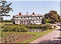
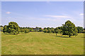
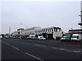
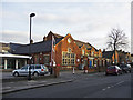
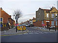
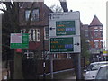
Photos of N13 4HF


Area Information
Living in N13 4HF means being part of a small, tightly knit residential cluster in north London, where the population of 2054 residents reflects a quiet, established community. This area is characterised by its modest scale, with homes predominantly in the form of detached or semi-detached properties. The median age of 47 suggests a mature demographic, with adults aged 30–64 forming the largest group. Daily life here is shaped by proximity to key transport links and local amenities, making it practical for commuters and families alike. While the area lacks the density of urban centres, it offers a balance of residential tranquillity and access to nearby services. The absence of major planning constraints, such as protected woodlands or areas of outstanding natural beauty, means development is unlikely to disrupt the existing character. For those seeking a low-flood-risk, stable environment with reasonable connectivity, N13 4HF provides a straightforward, unpretentious alternative to more congested parts of the capital.
- Area Type
- Postcode
- Area Size
- Not available
- Population
- 2054
- Population Density
- 5221 people/km²
The property market in N13 4HF is dominated by owner-occupied homes, with 61% of properties in private hands. This suggests a market skewed towards long-term residents rather than renters, though the exact rental availability is not specified. The accommodation type is predominantly houses, which are likely to be family homes or semi-detached properties. Given the area’s small size, the housing stock is limited, making it a niche market for buyers seeking specific properties. The lack of high-density development means competition for homes is lower than in larger urban areas, but buyers should consider the limited scope for expansion or redevelopment. For those prioritising private ownership and a traditional residential layout, N13 4HF offers a straightforward, if unexciting, proposition. The focus on houses also implies that flats or apartments are rare, which may appeal to those preferring larger living spaces.
House Prices in N13 4HF
No properties found in this postcode.
Energy Efficiency in N13 4HF
Residents of N13 4HF have access to a mix of retail and transport hubs within walking or short driving distance. Supermarkets such as Morrisons Palmers, Sainsburys Palmers Green, and Tesco Wood provide everyday shopping convenience, while the nearby rail and metro stations ensure easy travel to work or leisure. The ferry services to London Zoo and Camden Lock offer unique access to cultural and recreational spots, though they are supplementary to the main transport network. The area’s proximity to multiple stations, including Southgate and Arnos Grove, enhances its appeal for commuters. While the variety of amenities is modest, the practical reach of shops, transport, and leisure options suggests a lifestyle that prioritises accessibility over luxury. The absence of major entertainment districts means the area is more suited to those who prefer a quieter, service-oriented daily routine.
Amenities
Schools
| Rank | School | Type | Entry gender | Ages |
|---|
Explore more schools in this area
Go to Schools tabDemographics
The community in N13 4HF is predominantly composed of adults aged 30–64, with a median age of 47. This suggests a settled population, likely with established careers and families. Home ownership is high, at 61%, indicating a strong presence of long-term residents. The accommodation type is primarily houses, reflecting a preference for private, larger properties over flats. The predominant ethnic group is White, though no specific data on diversity or deprivation is provided. The age profile implies a mix of middle-aged professionals and retirees, with fewer younger families or students. This demographic structure may influence local services and amenities, which are tailored to the needs of an older, more mature population. The absence of detailed diversity statistics means the community’s full composition remains partially unexplored, but the data confirms a stable, homeowner-focused environment.
Household Size
Accommodation Type
Tenure
Ethnic Group
Religion
Household Composition
Age
Household Deprivation
NS-SEC
Explore more demographic insights in this area
Go to Demographics tabPlanning
Planning Constraints
- Flood RiskPremium
- Ramsar Wetland SitesPremium
- Area of Outstanding Natural BeautyPremium
- Protected Nature ReservePremium
- Protected WoodlandPremium