Area Overview for N13 4AJ
Photos of N13 4AJ
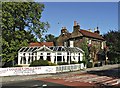

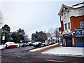
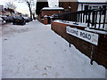

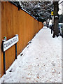
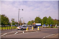
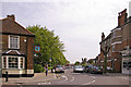


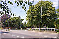
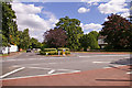
71 photos from this area
Area Information
Key information about the N13 4AJ including its size, population, and administrative classification.
- Area Type
- Postcode
- Area Size
- 9433 m²
- Population
- 1781
- Population Density
- 8968 people/km²
House Prices in N13 4AJ
43
Properties
£583,000
Average Sold Price
£165,000
Lowest Price
£1,225,000
Highest Price
Showing 43 properties
| Address | Type | Beds | Baths | Last Sale Price | Last Sale Date | |
|---|---|---|---|---|---|---|
| 69 Fox Lane, Southgate, N13 4AJ | Terraced | 5 | 1 | £1,225,000 | Apr 2022 | |
| 81 Fox Lane, Southgate, N13 4AJ | house | - | - | £1,070,000 | Jun 2021 | |
| 49 Fox Lane, Southgate, N13 4AJ | Semi-detached | 4 | - | £1,125,000 | May 2018 | |
| 43 Fox Lane, Southgate, N13 4AJ | house | - | - | £770,000 | Jul 2017 | |
| 47 Fox Lane, Southgate, N13 4AJ | Detached | 5 | 2 | £890,000 | Apr 2015 | |
| 65 Fox Lane, Southgate, N13 4AJ | Terraced | 5 | - | £752,000 | Mar 2013 | |
| 77 Fox Lane, Southgate, N13 4AJ | house | 5 | 2 | £682,000 | Feb 2012 | |
| 71 Fox Lane, Southgate, N13 4AJ | house | 5 | - | £500,000 | Sep 2011 | |
| 55 Fox Lane, Southgate, N13 4AJ | Flat | - | - | £249,000 | Nov 2005 | |
| 83 Fox Lane, Southgate, N13 4AJ | Terraced | - | - | £600,000 | Jul 2004 |
Page 1 of 5
Energy Efficiency in N13 4AJ
Amenities
Schools
| Rank | School | Type | Entry gender | Ages |
|---|
Explore more schools in this area
Go to Schools tabDemographics
Household Size
Family (3-5 people)
most common
Accommodation Type
Flats
most common
Tenure
69
majority
Ethnic Group
White
most common
Religion
N/A
most common
Household Composition
N/A
most common
Age
47
median
Adults (30-64 years)
most common
Household Deprivation
N/A
with no deprivation
NS-SEC
48
in Lower managerial occupations
Explore more demographic insights in this area
Go to Demographics tabPlanning
Planning Constraints
- Flood RiskPremium
- Ramsar Wetland SitesPremium
- Area of Outstanding Natural BeautyPremium
- Protected Nature ReservePremium
- Protected WoodlandPremium