Area Overview for N12 9EY
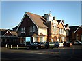
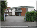
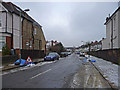
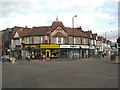
Photos of N12 9EY


Area Information
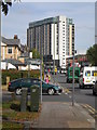
Living in N12 9EY offers a compact, densely populated residential experience within a small cluster of homes. The area covers 9,304 square metres and is home to 1,926 residents, creating a tightly knit community with a population density of 207,010 people per square kilometre. This postcode is characterised by a mature demographic, with a median age of 47 and a majority of residents aged between 30 and 64. The area’s proximity to transport hubs and retail amenities ensures daily life is convenient, while the low flood risk and below-average crime rate contribute to a sense of security. Residents benefit from excellent broadband connectivity (95/100) and accessible public transport, including multiple rail and metro stations. The presence of sixth-form colleges nearby suggests a focus on higher education, though primary and secondary schooling options are not explicitly listed. N12 9EY is a small, practical area ideal for those prioritising safety, connectivity, and proximity to London’s infrastructure.
- Area Type
- Postcode
- Area Size
- 9304 m²
- Population
- 1926
- Population Density
- 7069 people/km²
The property market in N12 9EY is characterised by a high rate of home ownership (69%), indicating that most residents are homeowners rather than renters. The accommodation type is predominantly houses, which contrasts with areas where flats or apartments dominate. This suggests a focus on family homes and long-term residency. Given the area’s small size and high population density, the housing stock is likely limited, with properties concentrated in a compact cluster. For buyers, this means competition may be fierce, and the range of available homes is restricted. The proximity to transport links and amenities could make the area attractive to those prioritising convenience over larger living spaces. However, the lack of specific data on property prices or types limits deeper analysis of the market.
House Prices in N12 9EY
No properties found in this postcode.
Energy Efficiency in N12 9EY
Residents of N12 9EY have access to a range of amenities within practical reach. The area includes five retail outlets, such as Aldi North, Co-op Woodhouse, and Tesco North, ensuring everyday shopping needs are met. Transport links are extensive, with metro, rail, and ferry options connecting to nearby stations like Woodside Park and Finchley Central. The presence of ferry stops, including Camden Lock Waterbus and London Zoo Waterbus Stop, adds unique leisure opportunities. While the data does not specify parks or recreational spaces, the area’s density and proximity to transport suggest a focus on convenience over expansive green spaces. The mix of retail and transport options creates a functional lifestyle, though those prioritising outdoor recreation may need to explore nearby areas for parks or nature reserves.
Amenities
Schools
The nearest schools to N12 9EY include Woodhouse College and Imperial College London Mathematics School, both of which are sixth-form colleges. These institutions cater to older students, typically those aged 16 to 18, and are focused on post-16 education. The absence of primary or secondary schools in the data suggests that families with younger children may need to look beyond the immediate area for schooling options. The presence of sixth-form colleges indicates a local emphasis on higher education and specialist training. While these schools are well-regarded, their focus on older students means they may not meet the needs of families requiring early years or secondary education. Prospective buyers should consider the availability of alternative schools in nearby areas.
| Rank | School | Type | Entry gender | Ages |
|---|
Explore more schools in this area
Go to Schools tabDemographics
The community in N12 9EY is predominantly composed of adults aged 30 to 64, with a median age of 47. Home ownership is high, at 69%, indicating a stable, long-term resident base. The area is primarily composed of houses rather than flats, reflecting a traditional housing stock. The predominant ethnic group is White, though specific data on diversity is not provided. The population density of 207,010 people per square kilometre is exceptionally high, suggesting a compact, closely packed residential environment. This density does not necessarily equate to overcrowding, as the area’s infrastructure, including transport and retail, appears to support its population. The demographic profile suggests a community of established professionals and families, with limited data on younger or older age groups.
Household Size
Accommodation Type
Tenure
Ethnic Group
Religion
Household Composition
Age
Household Deprivation
NS-SEC
Explore more demographic insights in this area
Go to Demographics tabPlanning
Planning Constraints
- Flood RiskPremium
- Ramsar Wetland SitesPremium
- Area of Outstanding Natural BeautyPremium
- Protected Nature ReservePremium
- Protected WoodlandPremium