Area Overview for N12 7LG
Photos of N12 7LG
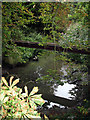
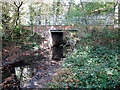
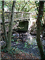
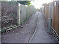


100 photos from this area
Area Information
Key information about the N12 7LG including its size, population, and administrative classification.
- Area Type
- Postcode
- Area Size
- 11.6 hectares
- Population
- 1878
- Population Density
- 941 people/km²
House Prices in N12 7LG
25
Properties
£553,250
Average Sold Price
£155,000
Lowest Price
£1,407,500
Highest Price
Showing 25 properties
| Address | Type | Beds | Baths | Last Sale Price | Last Sale Date | |
|---|---|---|---|---|---|---|
| 74 Linkside, North Finchley, London, N12 7LG | Semi-detached | 5 | 3 | £1,407,500 | Aug 2024 | |
| 50 Linkside, North Finchley, London, N12 7LG | Semi-detached | 4 | 2 | £976,000 | May 2024 | |
| 66 Linkside, North Finchley, London, N12 7LG | Semi-detached | 4 | 1 | £815,000 | Mar 2020 | |
| 58 Linkside, North Finchley, London, N12 7LG | Semi-detached | 3 | 2 | £760,000 | Jun 2019 | |
| 82 Linkside, North Finchley, London, N12 7LG | house | - | - | £517,000 | Nov 2012 | |
| 88 Linkside, North Finchley, London, N12 7LG | Semi-detached | 4 | 2 | £575,000 | Jun 2011 | |
| 84 Linkside, North Finchley, London, N12 7LG | house | 3 | - | £515,000 | Nov 2009 | |
| 86 Linkside, North Finchley, London, N12 7LG | house | - | - | £350,000 | Jul 2009 | |
| 80 Linkside, North Finchley, London, N12 7LG | house | - | - | £498,000 | Jun 2007 | |
| 60 Linkside, North Finchley, London, N12 7LG | Semi-detached | - | - | £405,000 | Apr 2005 |
Page 1 of 3
Energy Efficiency in N12 7LG
Amenities
Schools
| Rank | School | Type | Entry gender | Ages |
|---|
Explore more schools in this area
Go to Schools tabDemographics
Household Size
Family (3-5 people)
most common
Accommodation Type
Houses
most common
Tenure
78
majority
Ethnic Group
White
most common
Religion
N/A
most common
Household Composition
N/A
most common
Age
47
median
Adults (30-64 years)
most common
Household Deprivation
N/A
with no deprivation
NS-SEC
47
in Lower managerial occupations
Explore more demographic insights in this area
Go to Demographics tabPlanning
Planning Constraints
- Flood RiskPremium
- Ramsar Wetland SitesPremium
- Area of Outstanding Natural BeautyPremium
- Protected Nature ReservePremium
- Protected WoodlandPremium