Area Overview for N12 7LF
Photos of N12 7LF


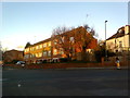
82 photos from this area
Area Information
Key information about the N12 7LF including its size, population, and administrative classification.
- Area Type
- Postcode
- Area Size
- 1.4 hectares
- Population
- 1476
- Population Density
- 5361 people/km²
House Prices in N12 7LF
24
Properties
£447,879
Average Sold Price
£145,000
Lowest Price
£975,000
Highest Price
Showing 24 properties
| Address | Type | Beds | Baths | Last Sale Price | Last Sale Date | |
|---|---|---|---|---|---|---|
| 10 Linkside, North Finchley, London, N12 7LF | Semi-detached | 3 | 1 | £832,999 | May 2022 | |
| 12 Linkside, North Finchley, London, N12 7LF | Semi-detached | 3 | 1 | £757,500 | Sep 2019 | |
| 6 Linkside, North Finchley, London, N12 7LF | house | 4 | 2 | £930,000 | May 2019 | |
| 4 Linkside, North Finchley, London, N12 7LF | Semi-detached | 5 | 3 | £975,000 | Sep 2017 | |
| 26 Linkside, North Finchley, London, N12 7LF | Semi-detached | 3 | - | £750,000 | Oct 2014 | |
| 28 Linkside, North Finchley, London, N12 7LF | Semi-detached | 4 | - | £619,000 | Oct 2009 | |
| 18 Linkside, North Finchley, London, N12 7LF | house | - | - | £410,000 | Aug 2009 | |
| 24 Linkside, North Finchley, London, N12 7LF | Semi-detached | 3 | 1 | £425,000 | Jul 2007 | |
| 8 Linkside, North Finchley, London, N12 7LF | Semi-detached | - | - | £435,000 | Nov 2005 | |
| 32 Linkside, North Finchley, London, N12 7LF | Semi-detached | - | - | £375,000 | Apr 2005 |
Page 1 of 3
Energy Efficiency in N12 7LF
Amenities
Schools
| Rank | School | Type | Entry gender | Ages |
|---|
Explore more schools in this area
Go to Schools tabDemographics
Household Size
Family (3-5 people)
most common
Accommodation Type
Houses
most common
Tenure
78
majority
Ethnic Group
White
most common
Religion
N/A
most common
Household Composition
N/A
most common
Age
47
median
Adults (30-64 years)
most common
Household Deprivation
N/A
with no deprivation
NS-SEC
57
in Lower managerial occupations
Explore more demographic insights in this area
Go to Demographics tabPlanning
Planning Constraints
- Flood RiskPremium
- Ramsar Wetland SitesPremium
- Area of Outstanding Natural BeautyPremium
- Protected Nature ReservePremium
- Protected WoodlandPremium